
Drone-Based Site Logistics Planning for Construction
A major building project nowadays has numerous moving parts.
Everything, from people to materials, needs to line up perfectly.
Getting big machines and all the raw materials where they need to be, exactly when they're needed, is extremely important.
Forget those outdated, manual methods of planning a site; drones give you a decisive advantage.
Drones give construction companies a bird's-eye view of the entire job site.
Gaining a comprehensive oversight of your daily commitments drastically streamlines both their preliminary organization and subsequent execution.
Read on to learn how project managers can leverage drone-based site logistics planning for construction.
Ready to view your construction project from new heights?
Contact 1st Choice Aerials today to schedule your aerial photography, inspection, or thermal imaging service!
On This Page:
What is Drone-Based Site Logistics Planning?
Drone-based site logistics planning uses aerial data collection to optimize the layout and flow of construction sites.
Drones fly overhead, snapping incredibly clear pictures and video.
This shows us exactly what a place looks like at the moment.
With drone information, project leaders can precisely plot out where all their gear, supplies, and construction projects will be located.
Drones equipped with high-resolution cameras or other sensors collect detailed imagery and measurements.
After we collect all that initial information, our special software gets to work.
It quickly builds super-accurate 3D models and detailed maps for the entire job.
Project managers use these models to picture the entire site clearly.
They quickly spot potential snags, dangers, and planning headaches early in the design stage.
This foresight prevents costly reworks and keeps the project budget firmly on track.
Drone Technology: Boosting Strategic Site Organization
Here are some practical advantages realized through the implementation of aerial vehicles.
Improved Accuracy and Data Collection
Drones provide exact measurements and data points.
This means site drawings are dead-on, and our material updates are much clearer.
With this information, teams can make informed decisions about where to place their tools, map out delivery routes, and store materials.
Traditional methods often depend on outdated maps or time-consuming ground-based surveys.
Drones offer up-to-date, comprehensive data captured quickly.
Collecting information well helps you avoid mistakes and rework.
Significant Time Savings
Drone surveys are exceptionally fast and can cover large, complex areas in a fraction of the time required for manual methods.
When operations move this swiftly, choices happen sooner, and your strategies gain the ability to pivot gracefully.
Picture how much smoother your weekly progress reports will become with this in your toolkit.
What could take a team of surveyors days or weeks to complete can often be done by a drone in a matter of hours.
Projects kick off fast. Then they keep moving at a quick pace.
You'll find that project managers can meet deadlines more easily when data arrives quickly.
Substantial Cost Reduction

While construction drones require an initial investment, they deliver significant long-term cost savings.
Imagine how much less manual effort goes into surveying an area, keeping an eye on project timelines, or performing vital safety checks.
That's what drones offer.
This directly reduces labor costs and associated expenses.
Better site planning from the start means fewer mistakes and less need for rework.
Effective material tracking reduces waste and ensures our entire supply chain operates smoothly.
Over the course of a large construction project, these savings add up substantially.
Safer Work Environment
Consider bridge inspections or tall cell towers; drones enable us to inspect these areas without putting a person at risk.
They can perform a safety inspection on scaffolding, rooftops, or unstable ground without putting anyone at risk.
Reaching dangerous places without harm truly gives us an edge.
When companies plan for safety, they have fewer accidents.
Ensuring adherence to safety protocols becomes much easier with regular drone flights.
How Drones Improve Specific Site Logistics Tasks
With the broader benefits now understood, we can investigate how drones optimize particular logistical operations at a contemporary building project.
Site Mapping and Modelling
We use drones to create highly precise 3D images of any construction site.
These models provide a clear view of the land's layout.
They precisely map its contours, existing structures, and the current state of the site with high fidelity.
Finding the perfect place for big machines, storing materials, and setting up site offices becomes easy with these helpful models.
When we position items thoughtfully, it makes the work process faster, clears up crowded areas, and drastically reduces the chance of injuries.
Drone-Based Material Reporting
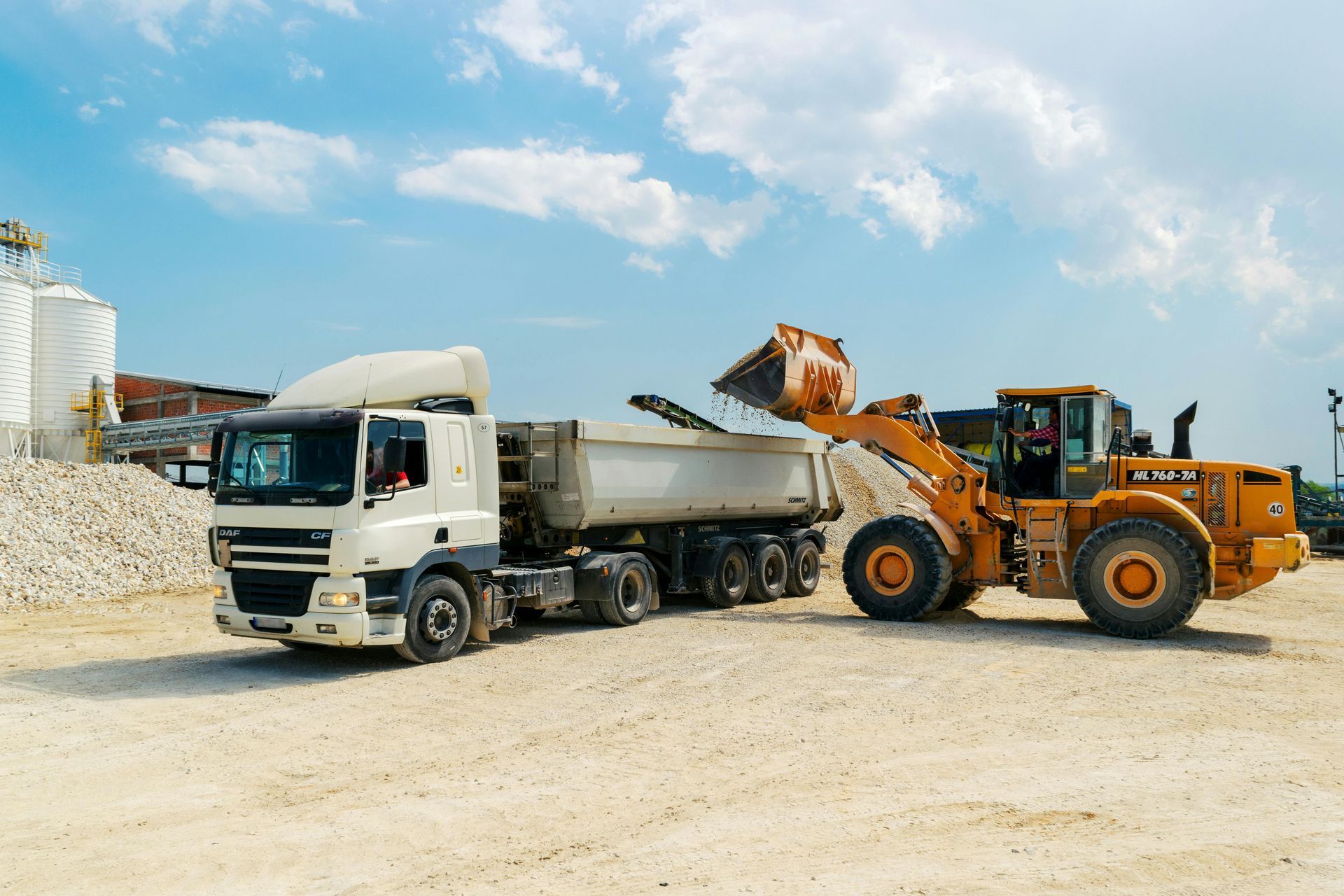
Drones help so much.
They enable you to easily track materials and maintain accurate inventory at any building site.
See your entire inventory from above!
You'll quickly get exact measurements of everything you've got stored.
Drone reporting on materials stops you from running out or having too much.
Drones give us precise counts of all our materials.
This way, supplies are always readily available, and work continues uninterrupted without long delays.
You'll free up valuable space and stop tossing money away on materials you don't need or ones that simply get ruined.
Achieving this level of asset management was challenging with manual inspections.
Analyzing Traffic Flow and Delivery Routes
Drone footage can be used to analyze the movement of vehicles, equipment, and workers within the construction site.
Nobody likes sitting in traffic. Good data enables city planners to get cars moving smoothly and reduce major slowdowns.
Safer roads and simpler workdays result from handling traffic effectively.
Planners utilize this data to design entrances that flow smoothly, sturdy roads for heavy loads, and ample, organized parking.
This keeps the construction site running smoothly and safely.
Implementing Drones in Your Construction Workflows
Are you ready to bring drone technology into your construction planning process?
Successfully adding drones means thoughtfully considering all angles and putting a clear framework in place.
Here is a simple guide to getting started.
1. Choose the Right Equipment and Software
Select drones and construction software that fit your project's specific needs.
Remember to check flight duration, image clarity, sensor types, and data processing methodologies.
Make sure the equipment can handle the size and complexity of your typical construction sites.
You can buy your own drones, or hire the experts.
What works for your company depends on its size and your specific needs, as each choice has its advantages and disadvantages.
2. Train Your Team Members

Invest in proper training and certification for your drone operators.
In the United States, commercial drone pilots are required to obtain an FAA Part 107 certificate.
Good training ensures safe, legal, and effective drone operations on your job site.
3. Develop a Consistent Flight Plan
Create a detailed flight plan before conducting any drone operations.
Ensure your plan clearly displays flight paths, altitudes, and precise data points.
With a smart strategy, you'll obtain clear aerial information reliably and without any risk.
4. Integrate with Existing Systems
Ensure your drone data can be integrated with your existing project management tools and construction software.
You might give your current tools a big upgrade.
Alternatively, you could opt for completely different setups.
Drone data can really help you with better decision-making but only if you connect it properly with your other information.
5. Stay Compliant with Regulations
Stay up-to-date with all local and national regulations governing commercial drone use.
This includes obtaining any necessary permits and adhering to all local flight restrictions.
Sticking to drone rules ensures your flights are both legal and harmless.
The Future of Drone-Based Site Logistics

The use of drones in construction management continues to advance.
Technology improves at an incredible pace.
New ways to use it show up every single day.
Get ready for some amazing things coming our way very soon.
1. AI and Machine Learning Integration
Artificial intelligence will further enhance the power of drone data analysis.
AI algorithms will be able to automatically identify patterns, detect potential risks, and track progress with minimal human intervention.
Imagine planning with true foresight, making smart moves long before they're needed.
2. Real-Time Onboard Data Processing
Future drones will be able to process data in real time, directly on the device.
This would allow for immediate adjustments to site plans and logistics based on live drone data.
Imagine updating your logistics plan on the fly as conditions on the job site change.
3. Fully Autonomous Drones
Self-flying drones are becoming more sophisticated.
Soon, they may be able to perform regular site surveys and safety inspections completely autonomously, without human pilots.
4. Deeper Integration with Other Technologies
Drones will integrate more closely with other construction technologies.
This includes Building Information Modeling (BIM) systems and a network of Internet of Things (IoT) sensors on site.
The entire work area will communicate like a well-oiled machine.
This level of integrated information will slash wasted time and boost output considerably.
Conclusion
Drone-based site logistics planning for construction is more than just a passing trend.
Imagine this: a system so powerful that it's completely transforming how you plan and complete every building project.
Precision skyrockets, expenses shrink, and safety standards rise.
The benefits are clear as day.
With drones continually improving, they're poised to take on many more tasks at today's construction sites.
The future of construction is here, and it is flying high. It is time to take your site logistics planning to the next level with the power of drone data.
Ready to view your project from new heights?
Contact 1st Choice Aerials today to schedule your aerial photography, inspection, or thermal imaging service!


