
Aerial Drone Mapping Services in Ohio
Drone Mapping Services Across Ohio
Get a high-resolution, accurate overhead view of your property, roof, or jobsite with professional drone mapping services in Ohio. 1st Choice Aerials delivers detailed aerial maps and 3D models that support construction planning, progress tracking, inspections, and documentation.
Our drone mapping solutions provide reliable measurements, visual clarity, and actionable data for commercial, industrial, and infrastructure projects throughout Ohio. Drone mapping services available in Dayton, Columbus, Cincinnati, and on projects statewide across Ohio.
Accurate Aerial Data for Planning, Progress, and Documentation
Our aerial mapping and modeling services are designed to support real-world project needs. Using advanced drone technology and structured flight planning, we capture high-resolution imagery that can be processed into precise 2D orthomosaic maps and detailed 3D models. These deliverables help project teams analyze site conditions, calculate measurements, monitor progress, and maintain a permanent visual record throughout each phase of a project. Services are available as one-time mapping projects or through recurring monthly documentation plans for active sites.
1. Request a Quote
Submit a quote request and receive prompt communication. A detailed response is typically provided within 24 hours.
1. Request a Quote
Submit a quote request and receive prompt communication. A detailed response is typically provided within 24 hours.
3. Drone Data Capture
Our drones follow a planned flight path to capture hundreds of overlapping, high-resolution images, ensuring complete and consistent coverage of your site.
2. Flight Scheduling
Once approved, we schedule the flight while accounting for weather conditions, airspace authorization, and site logistics to ensure safe and accurate data capture.
4. Receive Deliverables
You receive your completed 2D maps and/or 3D models in the requested format, ready for measurement, analysis, and documentation.
Our Drone Mapping Process
Project Examples
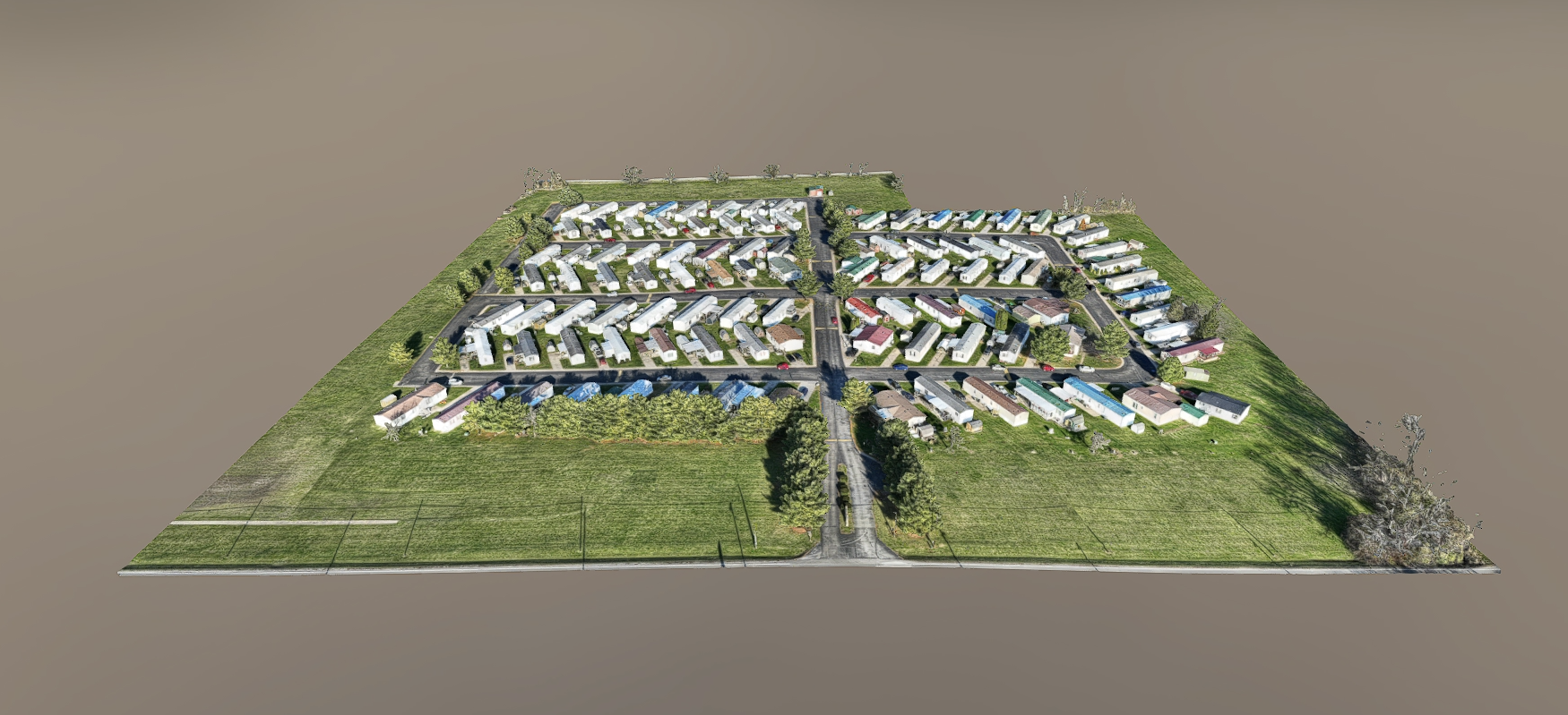
3D Site Modeling
3D model of a residential property showing unit layouts, roadways, and surrounding infrastructure for planning and documentation.
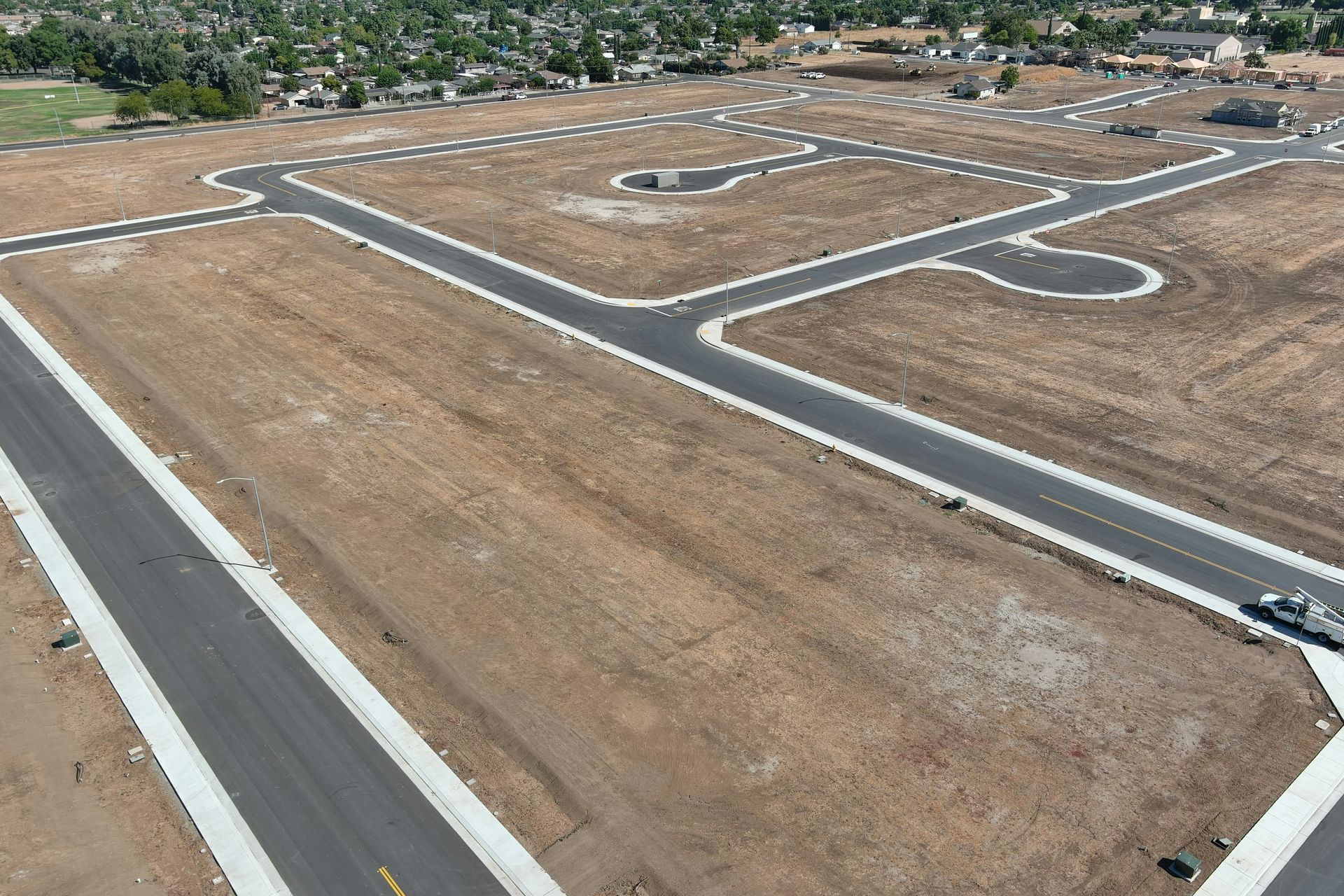
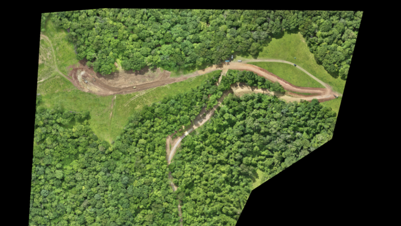
Construction Progress Mapping
Orthomosaic map of a roadway construction project used to document progress and site conditions over time.
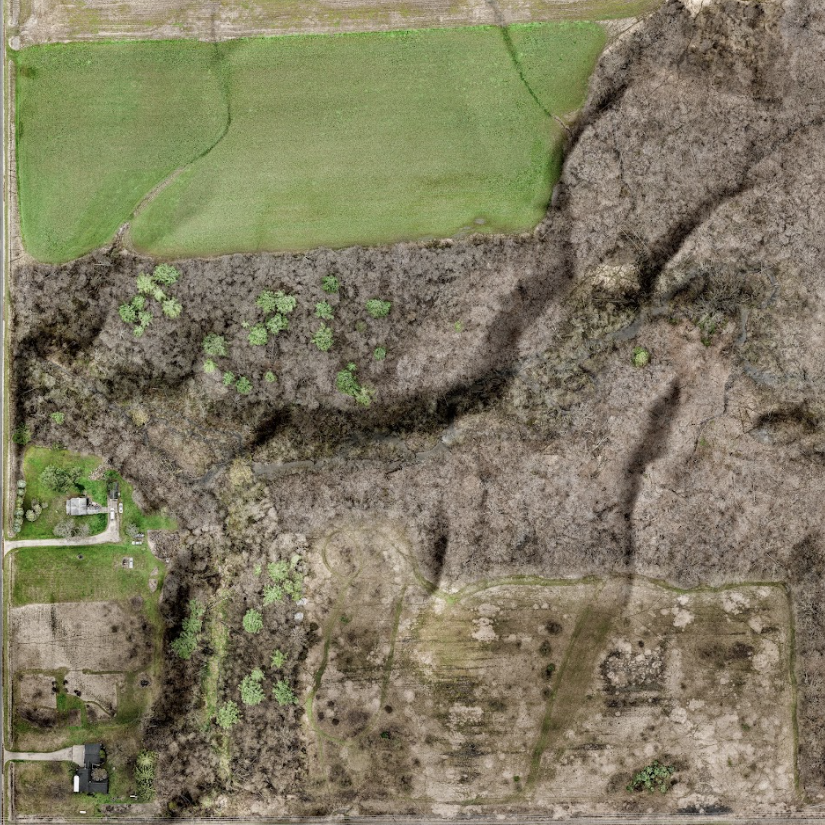
Property & Real Estate Mapping
2D orthomosaic maps used to showcase property layouts, access points, and surrounding features for marketing and planning.
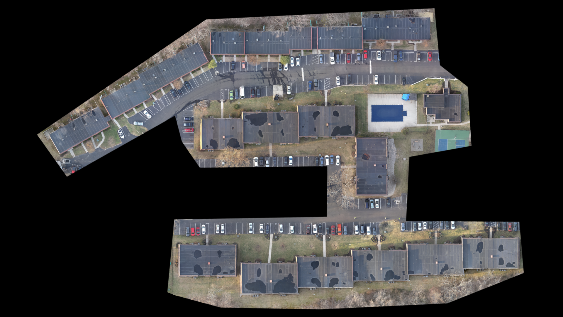
Roof Mapping & Documentation
High-resolution aerial roof models used for inspections, measurements, and maintenance documentation.
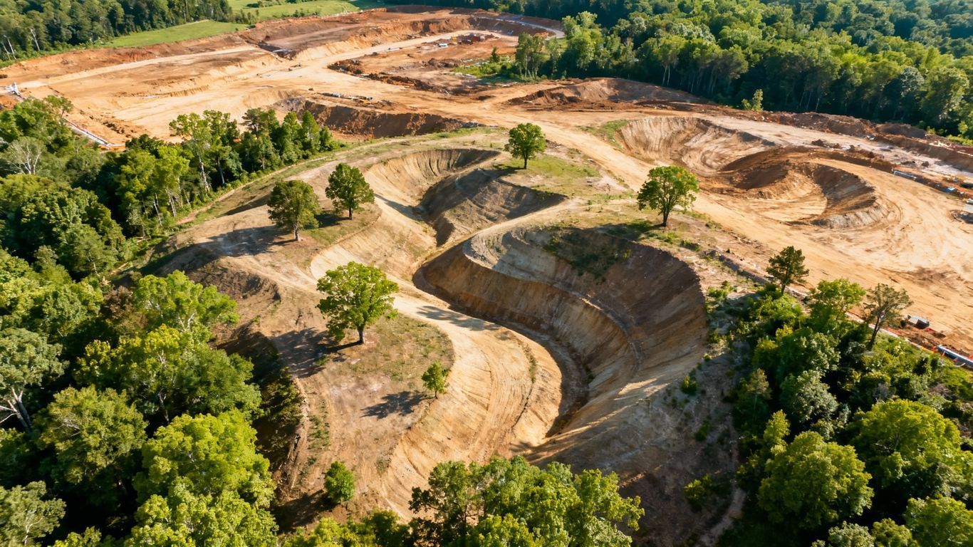
Infrastructure Mapping
Aerial mapping used to document construction progress and site conditions for utility and infrastructure projects.
Have a project in mind? We offer custom drone mapping solutions in Ohio. Give us a call and let’s talk it through.
Why Use Drone Mapping Services?
Drone mapping provides a faster, safer, and more cost-effective alternative to traditional ground surveys and manual documentation methods. By capturing accurate aerial data, teams can reduce time on site, improve safety, and gain a clearer understanding of project conditions. Our Ohio drone mapping services are commonly used for construction planning, inspections, real estate analysis, infrastructure projects, and long-term site documentation.
Reliable Deliverables You Can Use with Confidence
Every mapping project includes organized, easy-to-use deliverables designed for practical application. Depending on project needs, deliverables may include orthomosaic maps, 3D surface models, measurement-ready imagery, and visual records that support reporting, planning, and stakeholder communication.
Our goal is to deliver data that is accurate, accessible, and aligned with your project objectives.
Ready to Get Started?
If you’re looking for professional drone mapping services in Ohio, 1st Choice Aerials is ready to support your project with accurate aerial data and dependable results. Reach out today to get started and discuss your mapping needs.
Still Have Questions?
REACH OUT TO US TODAY
We're here to help! Whether you need more information about our aerial mapping services, don't hesitate to reach out. Our team is ready to assist you with any questions you may have.


