
Drone-Based Environmental Impact Assessment: A Guide
Getting a clear picture of a project's environmental implications can feel like a guessing game.
You want to move forward responsibly.
But those old ways of doing things?
They just give you bad or slow information.
What if you could get a bird's-eye view, packed with more detail than ever before, in a fraction of the time?
Imagine getting a completely fresh look at our environment.
Drone reports give us exactly that, shifting how we understand our world.
Ready to view your construction project from new heights?
Contact 1st Choice Aerials today to schedule your aerial photography, inspection, or thermal imaging service!
On This Page:
So What Is a Drone-Based Environmental Impact Assessment?
How do we know if a new factory will harm local wildlife?
That's where Environmental Impact Assessments, or EIA, come in.
It's how we predict a project's environmental footprint before it even begins.
This gives leaders a crucial perspective.
They can then clearly see how actions might affect the environment, for good or ill.
Before any new building goes up or a farm grows bigger, we give the land a thorough health check, just like a doctor examines a patient.
A drone-based environmental impact assessment advances this process significantly.
Instead of relying only on people walking the ground, we use drones, also known as unmanned aerial vehicles (UAVs).
When we look at technological advancements in environmental science, few innovations stand out quite like modern drone technology.
Outfitted with high-tech cameras and sensors, these devices record countless details from overhead.
You get a super clear picture of the location.
Picture knowing the exact height of trees, the vigor of plants, and the exact movement of water.
That kind of insight allows us to truly grasp the consequences of any changes.
The Major Benefits of Using Drones for Environmental Monitoring
Switching to drone operations isn't just about getting cool aerial photos.
You'll see direct gains.
These help your finances and protect our planet.
Get Far More Accurate Data
For years, environmental assessment work depended on satellite imagery and ground surveys.
Satellites can be expensive, their imagery is affected by cloud cover, and they sometimes lack the needed detail.
Ground surveys are time-consuming and can even be dangerous for the survey team in rough terrain.
Drones perfectly close this gap, working with amazing speed.
These things fly way below regular planes and satellites, snapping incredibly sharp pictures.
A recent study on how accurate drone data is found that using drones for surveying gives results just as good as older methods, but way faster.
Keep Your Team Safe
Many project sites have areas that are tough or dangerous to get to.
Think about steep hillsides, unstable ground after a storm, or delicate wetlands.
Sending a survey crew into these environments creates unnecessary risk.
Drones can fly over these areas with ease.
They gather all the necessary data while the operator stays safely on solid ground.
You'll feel much safer doing the work now. Plus, we're cutting down on potential legal headaches.
Save a Ton of Time and Money

Time is money on any project.
Traditional ground surveys require a lot of people and a lot of hours.
These problems stack up fast.
They cause work to fall behind schedule and equipment to guzzle more gas.
A single drone operator can often do the work of a whole survey team in a fraction of the time, surveying hundreds of acres in a single day.
Such swift operations directly reduce personnel expenditures.
This also substantially lessens the environmental burden by minimizing carbon emissions and other greenhouse gases.
Monitor Your Site Over Time
Environments change, so a proper environmental assessment is not a one-time snapshot; it is an ongoing process.
You've got to watch your project's true effect on the place for weeks, months, and years.
Drones make this incredibly easy.
They can be programmed to fly the exact same flight path again and again.
Imagine all your facts lined up just right.
You can then watch every small shift with pinpoint accuracy.
We absolutely need this to report correctly and manage our planet's health for the future.
Real-World Drone Applications Across Industries
The value of a drone-based environmental impact assessment becomes obvious when you see how different industries use it.
Construction and Infrastructure
Before breaking ground, construction companies need a full picture of the land.
Drones quickly map how water moves across the land.
This helps us spot fragile animal homes and set up ways to prevent soil from washing away.
Regular flights during construction can monitor erosion and ensure compliance measures are working.
After the project, mapping drones are used to track the success of site restoration efforts.
Folks can see fresh green plants sprouting, a clear sign that the whole natural area is coming back to life.
Agriculture and Farming
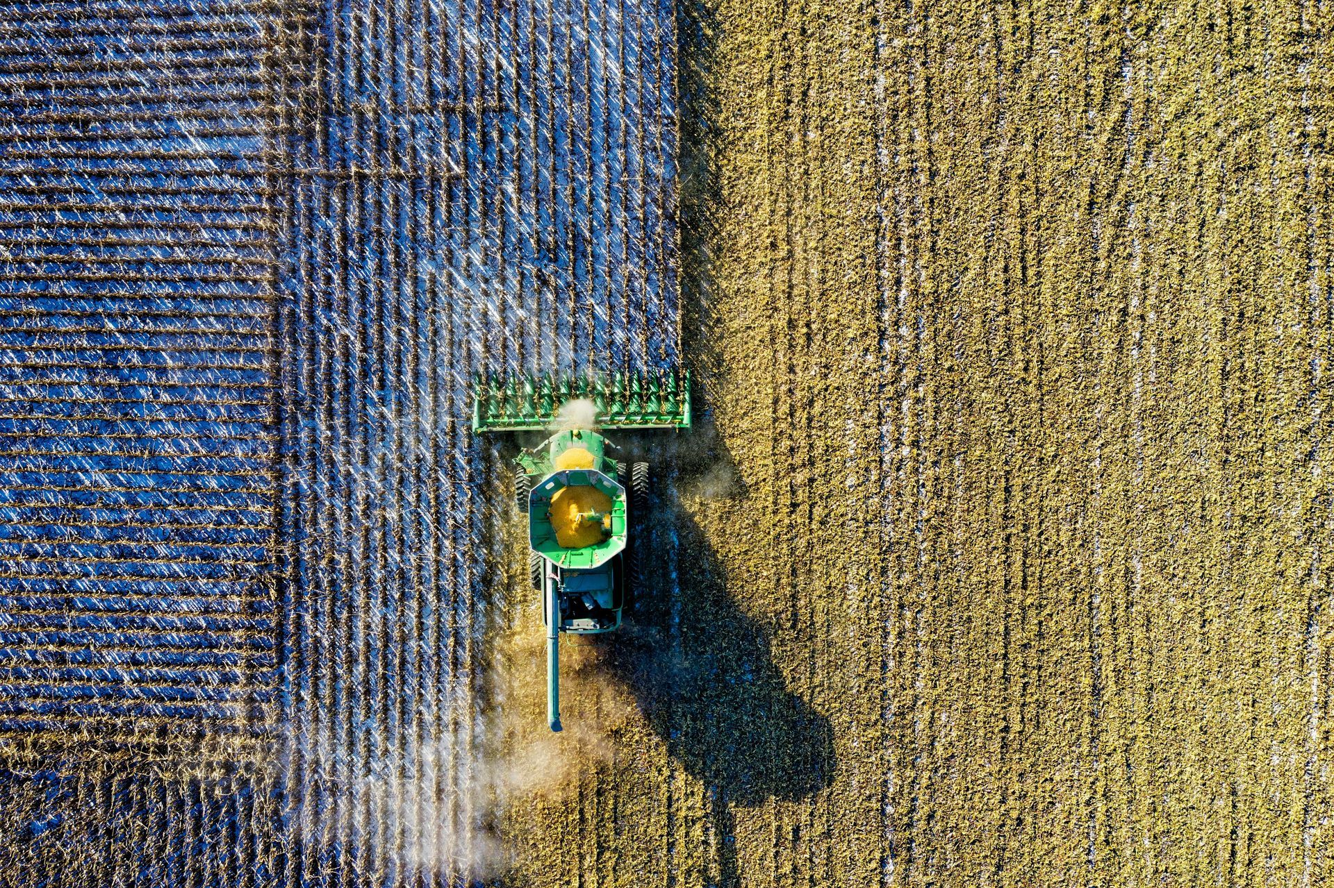
Modern farms are focused on sustainable practices.
Drones equipped with multispectral sensors can analyze crop health.
Farmers now target water and plant food applications with great accuracy.
This prevents excess chemicals from dirtying nearby streams and rivers.
They can also actively dig into soil samples.
This lets them pinpoint exactly where land is most likely to wash away.
This data helps us make smart choices about our land.
Mining
Big holes from mines and quarries reshape the land; drones help us keep a close eye on those shifts.
Picture precise 3D models of your material piles and digging sites.
Now you can easily count supplies and plan for what's next.
You'll notice our everyday tasks speed up quite a bit.
From an environmental standpoint, drones monitor tailing ponds for any signs of leaks.
Workers regularly check the nearby ground.
This helps stop dirt and water from spreading, keeping the air cleaner.
After a mine closes, drones help plan and monitor the massive task of land reclamation.
Renewable Energy
Placing wind turbines or solar farms requires careful site selection.
With drones, developers get clear, detailed maps of the ground's shape.
This helps them quickly find the ideal locations that have the least environmental impact for the installations.
They help us figure out how animals might be affected. This includes bird flight paths.
Once operational, thermal cameras on drones can inspect solar panels for defects.
Drones handle wind turbine blade checks both safely and fast.
This keeps green energy sources running at peak performance.
Conservation and Forestry
Protecting our natural spaces requires good data.
Conservation groups use mapping drones equipped with various sensors to conduct wildlife counts and wildlife monitoring without disturbing the animals.
Imagine tiny eyes in the sky!
They help us identify where forests are disappearing and if invasive new plants are encroaching.
Drones are now a game-changer in the fight against poaching.
Groups such as the World Wildlife Fund report they're essential.
Drones can scan vast areas of land for suspicious activity and help the ground team navigate the woods safely.
Drones also give foresters eyes in the sky, catching sick plants or a possible fire early.
You can also gather data on air quality using drone technology.
The Technology Powering the Process

The drone itself is just the platform.
Its power lies in the sensors it carries.
- RGB Cameras: These are high-resolution cameras similar to what you would find in a professional photography setup. They snap crisp photos to build accurate maps and lifelike 3D models.
- LiDAR: This stands for Light Detection and Ranging. LiDAR sensors shoot out laser pulses to measure distances, creating incredibly precise 3D point clouds of the terrain. It can even see through dense tree cover to map the ground beneath.
- Multispectral Sensors: These devices capture light in various bands from the whole electromagnetic spectrum. You can truly see how well plants are doing, how clean the water is, and what's inside the soil.
- Thermal Sensors: These detect heat signatures. With these, you can find hidden water, observe night animals, or even pinpoint buried steam lines and pollution.
From Data to Decisions: Software and AI
All of this raw data is processed using powerful software.
Thousands of pictures and data flow into the system.
It then builds them into very detailed maps and models.
Artificial intelligence really steps up to the plate right here.
AI programs can quickly spot and sort different items.
For instance, with AI analysis, you might count certain trees or various animal species.
By comparing information from different flights, you can quickly tell you what's changed.
For instance, it will highlight areas with significant soil erosion or where a lot of plants have disappeared.
Project managers gain practical advice from the data, not just a heap of numbers.
They can immediately put these ideas to work.
Drones as an Environmentally Friendly Option
Besides drones being used as a tool for Environmental Impact Assessment, they can also be used as alternatives for cleaner ways of doing things.
Drones use battery power, minimizing the use of gas fuel, eventually reducing emissions and carbon footprint in areas where they are used.
For instance, drone-based delivery systems like the Amazon Prime Air service replace trucks in rural areas, minimizing energy consumption while minimizing the need to build roads.
This process may have more environmental implications.
During mapping, you can use drones to map large tracts of land instead of using vehicles to navigate the area, minimizing any disturbance to the land compared to using vehicles.
Conclusion
When businesses use drones for environmental impact studies, everyone gains—companies see improved efficiency, and the planet receives better care.
You'll get all the project details you need, delivered swiftly, safely, with impressive accuracy, and without overspending.
Implementing these advanced technologies will significantly reduce our environmental footprint and alleviate the impacts of climate change.
Think cleaner energy for freight, less waste in crop production, and long-term environmental benefits for the planet.
Through package delivery, drones offer better alternatives to human actions that cause more harm to the environment.
Ready to view your project from new heights?
Contact 1st Choice Aerials today to schedule your aerial photography, inspection, or thermal imaging service!


