
Enhance Projects with Cincinnati Aerial Site Survey Services
You've probably stood at the edge of a new project site and felt overwhelmed.
You're looking at acres of land, trying to imagine the finished building, road, or farm.
The old way meant weeks of surveyors on foot, a mountain of paperwork, and a final map that still left you guessing.
This traditional approach is slow, costly, and frankly, incomplete.
It's time to talk about what Cincinnati aerial site survey services can do for your bottom line and your peace of mind.
These modern surveying solutions provide comprehensive data for any site development.
Imagine getting a complete, bird's-eye view of your entire property in just a few hours.
This isn't science fiction; it's what modern drones deliver.
We're talking about a level of detail that ground crews could only dream of, captured faster and safer than ever before through advanced aerial surveys.
Ready to view your construction project from new heights?
Contact 1st Choice Aerials today to schedule your aerial photography, inspection, or thermal imaging service!
On This Page:
Why Your Project Can't Afford to Ignore Aerial Surveys
Sticking to old methods feels safe, but it could be costing you more than you think.
Aerial surveying isn't just a novelty; it gives a real competitive advantage.
They deliver on the three things every project manager cares about: speed, accuracy, and safety.
Save Time and Money (The Big Two)
This is where things get really interesting for land development projects.
A drone can survey a 50-acre site in a couple of hours, a task that might take a ground crew a full week.
You get your data faster, which means your project can start sooner and move more quickly through its phases.
Because the work is completed more quickly, the labor costs are significantly lower.
You also reduce the chances of expensive rework.
Having a perfectly accurate model of your site from day one means fewer surprises pop up during construction, protecting your budget.
Get a Crystal Clear Picture
An aerial survey captures millions of data points, compared to the few hundred a ground crew might collect.
This creates an incredibly detailed orthomosaic map, where every inch of the property is in perfect focus.
You can zoom in and inspect specific areas without ever leaving your office.
You can also get 3D models that let you view the site from any angle.
This helps you understand the topography in a way a flat map never could.
This comprehensive view helps architects, engineers, and stakeholders align on design plans.
A Safer Way to Survey
Some sites are just plain dangerous for survey crews.
Steep slopes, unstable ground, or areas with heavy machinery create serious risks for pedestrians.
Sending a drone in to do the work keeps your team safely on the sidelines.
This completely removes the risk of slips, trips, and falls in hazardous terrain.
The drone operator can remain in a safe location while the UAV handles the tough parts.
Better Data for Better Decisions

Ultimately, a project's success comes down to the quality of your decisions.
High-quality data leads to better decisions.
Accurate surveying with aerial methods can give you centimeter-level accuracy, giving you confidence in your measurements and plans.
You can use this data for everything from initial site plans to tracking construction progress on a weekly basis.
It makes communicating with investors and clients easier because you can show them exactly what's happening.
The highest level of detail is simply unmatched by traditional methods over large areas.
Exploring the Range of Surveying Services
Modern aerial surveying services provide a wide array of mapping solutions for different needs.
Understanding these options helps you choose the right product for your project.
The services land surveyors offer have expanded greatly with drone technology.
Topographic Surveys
A topographic survey is one of the most common requests for any land development project.
These surveys map the contours and elevations of a property, identifying natural and man-made features.
Aerial lidar mapping is exceptionally good at producing detailed topographic surveys quickly and accurately.
This information is fundamental for civil engineering and landscape architecture.
It informs drainage design, site grading, and the placement of buildings and infrastructure.
The detailed elevation data from a drone-based topographic survey is far more comprehensive than what older surveying methods could produce.
Boundary, Title, and ALTA/NSPS Surveys
While a licensed professional surveyor must still set physical property corners on the ground, drones play a vital support role in boundary surveys.
The aerial imagery provides context and helps identify potential encroachments or discrepancies.
This is crucial for establishing clear land title.
For commercial real estate transactions, ALTA/NSPS land title surveys are often required.
These detailed surveys combine elements of boundary surveys, topographic surveys, and improvement location.
Drones accelerate the collection of topographic and feature data, making the creation of ALTA/NSPS land title surveys more efficient.
The combination of ground control and aerial data provides a complete picture for title surveys.
The process supports the creation of precise legal descriptions.
This comprehensive approach is necessary for ALTA/NSPS land title surveys, right-of-way, and easement documentation.
Right-of-Way Surveys

Infrastructure projects like roads, pipelines, and utilities require detailed right-of-way surveys.
These surveys define the specific strip of land needed for the project.
Drones are perfect for mapping these long, linear corridors efficiently.
The data collected assists in every phase, from initial planning to final right-of-way plan development.
This information helps engineers plan the route, and it is used to create the legal documents for land acquisition.
Accurate surveying is essential for successful right-of-way plan execution.
Specialized Surveys
Drone technology also enables highly specialized surveying solutions.
For properties near rivers or lakes, hydrographic surveys can map the terrain beneath the water's surface using specific sensors.
This is vital for marina design, dredging operations, and environmental assessments.
In areas prone to flooding, drones can gather the precise elevation data needed to obtain FEMA elevation certificates.
These documents are often required for construction permits and flood insurance.
An elevation certificate from an accredited professional confirms a building's height relative to the base flood elevation.
Who Needs Cincinnati Aerial Site Survey Services?
You might be wondering if this technology is right for your industry.
The short answer is yes.
Various sectors in the Cincinnati area are already seeing huge benefits from using aerial survey data.
Commercial Real Estate
For developers, getting an aerial view is a game-changer.
You can evaluate potential properties faster, checking for drainage issues or other red flags from the air.
You get excellent marketing materials to show investors and potential tenants what the site and surrounding real estate look like.
Before breaking ground, these surveys help with site layout and infrastructure planning.
It makes the entire pre-development phase more efficient.
This technology helps you present your vision with stunning clarity and supports all aspects of land development.
Construction and Infrastructure
This is one of the biggest fields using aerial surveys.
Project managers can track progress against plans with regular flights.
They can confirm that earthwork is being done to spec by calculating soil stockpile volumes directly from the 3D model.
It's also great for quality control, construction layout, and as-built verification.
According to a report by DroneAnalyst, the construction industry continues to be a top adopter of drone technology.
This data, often integrated into civil engineering software, helps you spot problems early before they become expensive to fix.
Agriculture's High-Tech Helper
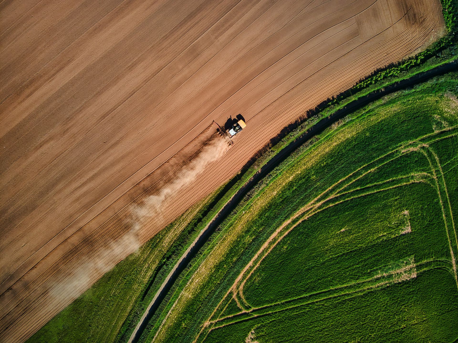
Modern farming is all about precision.
Drones equipped with multispectral sensors can fly over fields and identify crop stress that is invisible to the human eye.
This lets farmers apply water or nutrients only where they are needed.
This saves money on resources and can increase crop yields.
It's also used to assess plant health and count crops.
Information from a Purdue University extension program highlights how these digital tools improve farm management.
Solar Panel Installation
Placing solar panels for maximum efficiency is critical.
Aerial surveying can quickly map a large area, such as a roof or field.
The 3D model generated can then be used to analyze sun exposure and identify any shading from trees or nearby buildings.
This allows solar installers to design the most productive layout possible.
It also makes the initial measurement and proposal process much faster and more accurate.
This leads to better system performance and happier customers.
Environmental Monitoring
Protecting our natural resources requires accurate data.
Drones are used to monitor coastlines for erosion, map wetland boundaries, and track changes in wildlife habitats.
They offer a low-impact way to gather data for environmental assessments in sensitive areas.
Environmental consultants can use the information to plan restoration projects.
They can also monitor the health of forests or the spread of invasive species.
It's a powerful tool for responsible environmental stewardship and is often used for control surveys.
What to Look for in a Cincinnati Drone Survey Provider
Not all drone services are created equal.
You are trusting this provider with a critical part of your project.
Here are a few key things to check for before you hire anyone.
First and foremost, verify the pilot holds a current FAA Part 107 certificate.
This is the law for any commercial drone operation in the United States.
Flying without it is illegal and opens you up to massive liability.
The provider should be, or work directly with, licensed professional surveyors.
This is especially important if you need certified boundary surveys, topographic surveys, or FEMA elevation certificates.
The surveyor's stamp adds legal authority to the data.
Ask to see their portfolio of past projects, especially any in your industry.
This shows they have the right experience.
Also, confirm they carry significant liability insurance in case of an incident.
Finally, talk to them about the final deliverables.
A good provider will understand the distinct needs of a civil engineering firm versus a real estate agent.
They should be able to give the data in a format your team can use right away for their construction staking or site development plans.
Conclusion
Relying on old, slow, and incomplete surveying methods is no longer a viable option in today's fast-paced environment.
The technology to do better is here now.
It's more accessible and more affordable than you might think.
The comprehensive surveying services include everything from boundary surveys, topographic surveys, ALTA/NSPS land title surveys, to specialized lidar mapping.
From construction and real estate to agriculture and solar, this technology offers a clear path to working smarter.
Getting better data faster saves you time, cuts your costs, and lowers your project risks.
Ready to view your project from new heights?
Contact 1st Choice Aerials today to schedule your aerial photography, inspection, or thermal imaging service!


