
Benefits of Drone Data for Construction Project Management
Overseeing a building job means handling many shifting pieces.
You consistently manage the project's timeline and financial constraints.
Simultaneously, safeguarding your personnel remains paramount in all operational decisions.
Try to picture it now: Just one little mistake right now could totally wreck the whole thing.
A single glance at the whole project can really shift how you get things done.
Why does aerial data truly matter for project success?
Project managers can keep their tasks organized and catch little problems early.
This stops those small issues from growing into big messes later on.
Ready to view your construction project from new heights?
Contact 1st Choice Aerials today to schedule your aerial photography, inspection, or thermal imaging service!
On This Page:
What Is Construction Drone Data, Exactly?
When discussing drone data, we are referring to more than a quick video of the job site.
This data gives you a full digital picture of your project.
It starts with high-resolution aerial images and 4K videos that document site conditions.
But the capabilities go much deeper.
Drones use a technique called photogrammetry to stitch together hundreds or thousands of drone-captured images, creating a highly accurate, measurable 3D model of your entire site.
Want aerial photos you can measure with?
Orthomosaic maps are just that – overhead pictures fixed up so perfectly, you can get precise measurements, just like a standard map.
Some drones are equipped with LiDAR sensors, which use laser pulses to create incredibly detailed point clouds.
This system catches the smallest shifts on a construction site.
It gives you incredible detail, something really hard to get before.
Key Benefits of Drone Data for Construction Project Management
You may be wondering how these advanced maps and models practically assist you daily.
It comes down to how well they take the toughest parts of your job and make them straightforward.
From the initial survey to the final project handover, this data makes a tangible difference.
Superior Site Surveying and Planning
Consider the time it takes to complete a traditional land survey.
Getting this done often means a whole team spending days, sometimes even weeks, working right there on site.
A construction drone can perform the same survey work in a fraction of the time.
A single flight can capture topographic data for a large area in just a few hours.
This quickness lets you start planning and figuring out dirt work much faster.
This is not just about speed; it also concerns the level of detail.
Drone scans give us 3D models that show the site exactly as it appears right now.
Picture knowing every hill and tough spot on the land before you even sketch a line.
That lets you plan roads and map out the property with much greater ease.
For large infrastructure projects, a fixed-wing drone with extended flight times can cover vast areas efficiently.
For more complex sites that require vertical takeoff and landing, a vtol drone offers great flexibility.
Today's RTK drones often hit survey-level precision, which is perfect for getting exact measurements.
Constant Project Monitoring and Progress Tracking
How do you currently track project progress?
Traditional methods may include walking the site, taking notes, or relying on reports from foremen.
You might find these methods handy, but what *you* see could hide crucial facts from others.
Consider drones your truthful eye in the sky.
They log how projects advance, visually, over time.
Schedule flights weekly or bi-weekly.
You'll always have a steady, clear view of your building projects from above.
You can overlay this new project data on your original plans to see exactly where you stand.
Matching up what was built with what was planned gives you a real advantage.
It immediately highlights if a foundation was poured in the wrong spot or if excavation is falling behind schedule.
Catching these deviations early saves you from the massive costs and delays associated with rework later on.
A Safer Job Site for Everyone
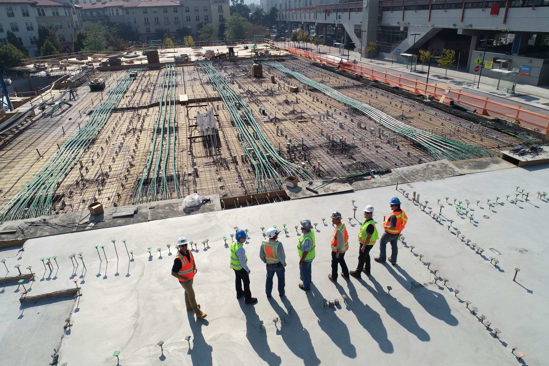
Safety is the top priority on any construction site.
You always work to lower risks.
This keeps your team out of danger.
Site safety has dramatically improved with the regular use of drones.
They allow you to inspect hard-to-reach or dangerous locations without putting a single person at risk.
Consider inspections of scaffolding, rooftops, or the edges of deep excavations.
A drone can get a close-up look while the operator remains safely on the ground.
It's equally important to diligently observe and assess any potential hazards present on the premises.
You can identify potential issues, such as unsafe material storage or pooling water in hazardous areas, from a safe distance.
The U.S. Bureau of Labor Statistics consistently lists falls as a leading cause of fatalities in construction, and using drones for inspections at height directly addresses this critical issue.
Streamlined Communication and Teamwork
Aligning everyone is one of the toughest parts of project management.
You need to communicate with owners, architects, engineers, subcontractors, and your own crew.
When we misinterpret, things stall and arguments ignite.
Drone data serves as a single source of truth that everyone can understand.
A 3D model or high-resolution map is much clearer than a phone call or a lengthy email chain.
You can share a simple link, allowing a stakeholder on the other side of the country to see the exact same view as you.
Visuals bridge any message disconnect.
During a progress meeting, you can pull up the latest drone map, and everyone can see the real state of the project.
When conversations are focused, the efficacy of information exchange improves, leading to a more expeditious and well-considered resolution.
Smarter Cost and Resource Management
Every cubic yard of dirt and every pound of rebar represents a cost.
How well you handle your team, tools, and budget directly decides if a project turns a profit.
When you use drone data, counting and tracking your materials becomes incredibly exact.
For example, calculating stockpile volumes is notoriously difficult with traditional methods.
With a drone's 3D model, you can get a highly accurate volume measurement with just a few clicks.
Knowing exact stock levels means you won't buy too much or run out of what you need.
When blunders are avoided, you don't waste cash. This keeps your budget healthy.
As mentioned, identifying mistakes early is much cheaper than fixing them later.
Finding an issue that might cost $1,000 to fix in the first week could save you from a $100,000 problem months down the line.
Conclusion
Folks aren't just curious about construction drones anymore; they're talking about how these tools actually get jobs done.
Today's technology puts project managers in charge like never before, offering a view they couldn't get ten years back.
You'll keep every task on track, costs under control, and everyone safe from start to finish.
Using drone data for your construction projects shows you its worth isn't simply about the tech.
Construction sites run better with drones, as they provide exact details quickly and openly.
Flying from the first ground scan to the last safety check, drones have become game-changers for project work.
Ready to view your project from new heights?
Contact 1st Choice Aerials today to schedule your aerial photography, inspection, or thermal imaging service!


