
Professional Aerial Photography Services: Reach New Heights
Getting high-quality aerial photography services from the sky used to be complex and costly, often requiring significant resources.
Consider a different angle - you might be surprised at the results. Everything changes.
Professional aerial photography services have made high-quality aerial images readily available.
These photography services give you a bird's-eye view that's hard to replicate from the ground.
Imagine: detailed records of an aircraft's creation, close-up drone inspections, or breathtaking flight photo—all possible with the versatile tools of aerial photography.
Pros and hobbyists alike will find these services beneficial - let's see how.
Ready to view your construction project from new heights?
Contact 1st Choice Aerials today to schedule your aerial photography, inspection, or thermal imaging service!
On This Page:
What Are Aerial Photography Services?
At its foundation, aerial photography involves capturing images from an elevated position.
Historically, this required manned aircraft like planes or helicopters.
Think about those classic flyover shots providing wide area views.
Things aren't the same anymore.
Technology has reshaped our world.
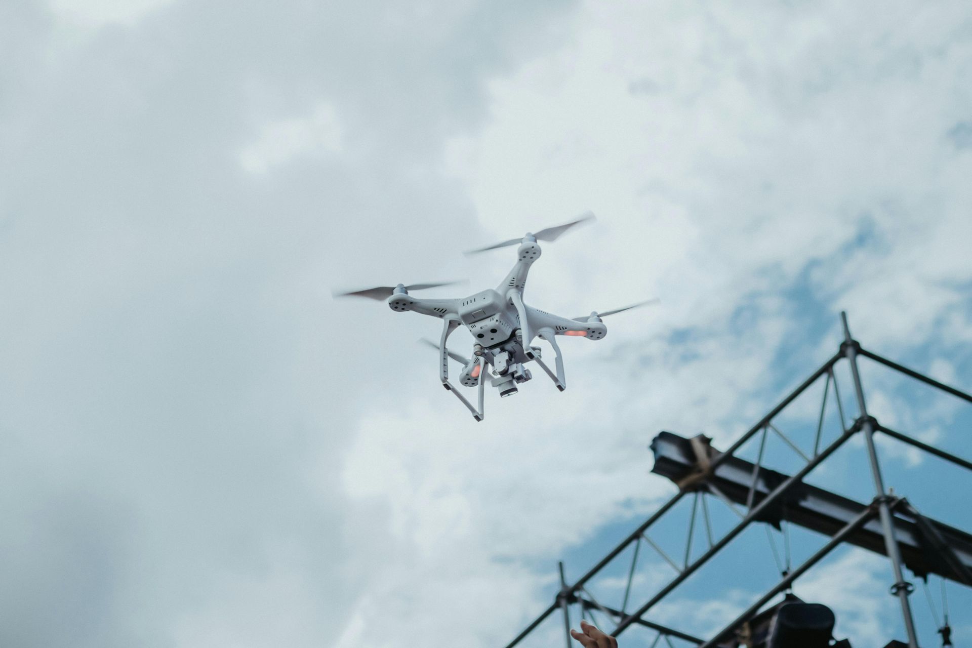
Aerial photography now relies heavily on drones, or UAVs.
Drones with high-resolution cameras get up close and personal with their subjects.
This gives you incredibly detailed images perfect for real estate photos or tough inspections—far better than what you'd get from a regular plane.
So, aerial photography services encompass taking photos or drone videos from any flying platform.
This process includes flight planning, operating the drone or aircraft, and post-processing the collected images or footage.
Providers of drone services handle the technical aspects, ensuring you receive amazing, high-quality visuals tailored to your project's needs.
Drones vs. Manned Aircraft: Choosing Your Platform
The choice between using a drone service or a traditional manned aircraft often depends on the specific job requirements.
The best platform depends on what you need - they all have their strengths.
Choosing the best aerial photography service depends on understanding their differences.
For example, rural property needs differ greatly from the close-up inspections of telecommunications infrastructure.
Drones: They're Everywhere Now
Drone photography and videography have really taken off.
Aerial work with drones is super popular now.
Because they're small, they can fly where others can't, making detailed jobs easier.
Low-altitude flight makes them ideal for close-up work.
Inspecting farmland or watching construction is a breeze.
Utilizing professional drone services is frequently more affordable than hiring a plane or helicopter.
Fewer personnel are required, operational costs are lower (no fuel needed for electric drones), and deployment can be much quicker, contributing to faster turnaround times.
It's easy to get drone services. Many companies cover the entire country, saving you the cost of travel.
Think of the time saved, too!
Traditional Manned Aircraft
Planes and helicopters retain their importance in professional aerial photography.
They can cover vast areas much more rapidly than drones.
Big mapping projects?
Aerial surveys of vast land?
Monitoring huge facilities like sprawling industrial sites or golf courses?
This is the tool for the job.
Manned aircraft can also fly significantly higher and carry heavier, more sophisticated camera equipment and sensors, like advanced thermal imaging systems or LiDAR scanners.
If your project requires images from several thousand feet above ground level or needs specialized payloads, a manned aircraft is often the necessary choice.
The Technology Behind the Lens
Achieving great aerial photos and videos doesn't happen by chance - it relies on sophisticated technology.
Aerial photography's power and data collection potential become clearer when you understand the technology behind it.
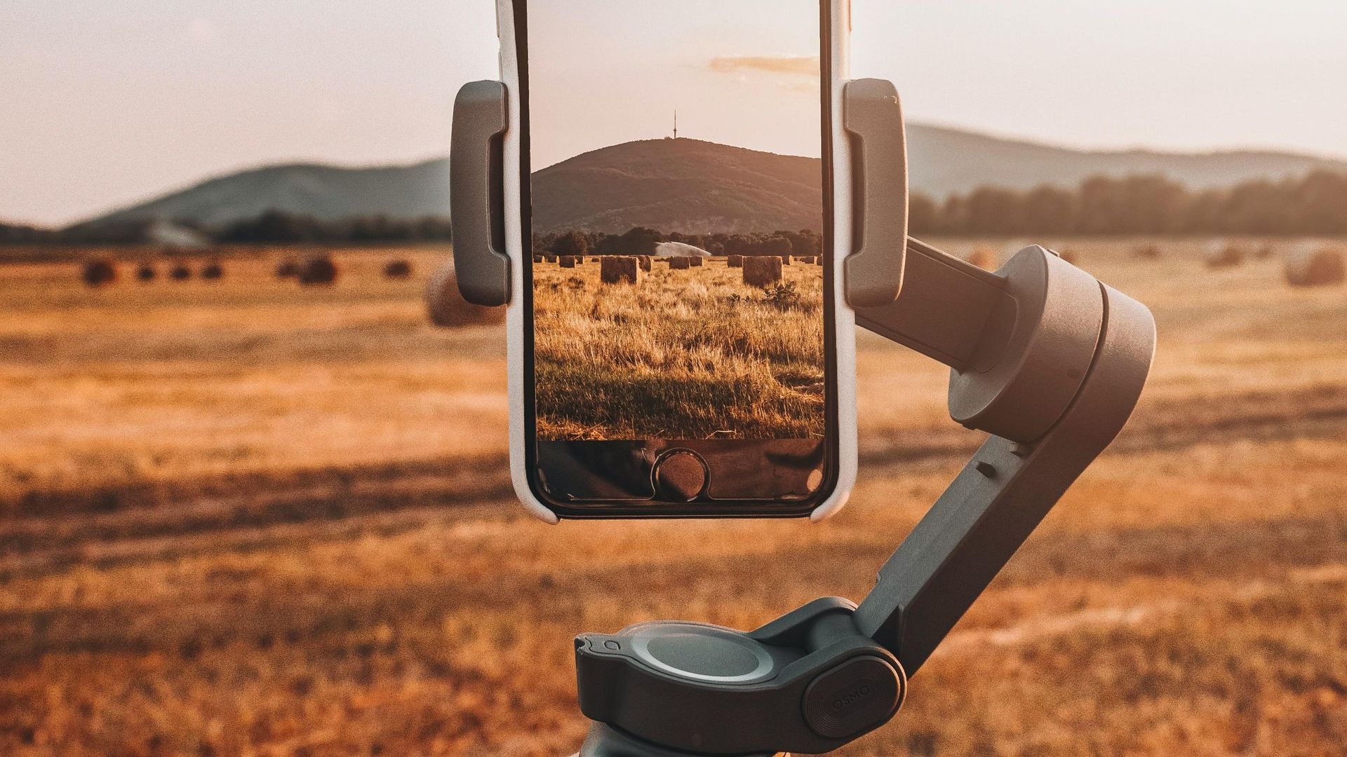
Cameras and Sensors
Aerial cameras vary widely, from standard high-resolution DSLRs and mirrorless cameras to specialized imaging systems designed for specific data collection tasks.
Seeing tiny details from afar is important, whether you're checking a part or mapping land.
High resolution makes this possible.
Think of it like this: a bigger sensor captures more information, a better lens focuses that information sharply, and a wider dynamic range handles both light and shadow beautifully.
All three together make or break your aerial photos.
Inspectors and energy auditors sometimes use thermal imaging sensors, in addition to regular cameras.
Agricultural analysis and environmental monitoring get a boost from multispectral cameras.
These cameras pick up light invisible to our eyes.
Laser pulses from LiDAR systems produce incredibly accurate three-dimensional models.
This technology allows for precise analysis of everything from landscapes to buildings and infrastructure.
Stabilization Matters
Maintaining a steady camera platform while airborne is absolutely crucial for usable imagery.
Gimbals—mechanical or electronic—smooth out shaky camera footage by counteracting drone or aircraft movement.
This stabilization ensures smooth, cinematic drone video footage and sharp, clear aerial photos, even when operating in moderately windy conditions.
Flight Control Systems
Modern drones rely heavily on GPS and other satellite navigation systems (like GLONASS or Galileo), along with internal sensors (IMUs, barometers), for precise positioning and navigation.
Advanced flight control systems allow the drone operator to plan automated flight paths using waypoint navigation.
Imagine needing perfectly overlapping aerial photos to create a detailed map of a construction site.
This function ensures that it happens, leading to precise data for all kinds of projects – from surveying land to inspecting bridges.
It's all about dependable, overlapping coverage.
Choosing the Right Aerial Photography Services Provider
Not all aerial photography services deliver the same level of quality or professionalism.
Whether you're in real estate or construction, finding the right provider, whether a local drone operator or part of a nationwide network, significantly impacts the quality, reliability, and usefulness of the final images or data.
Choosing?
Consider this first.
Experience and Portfolio
Seek out a provider with demonstrable experience, particularly in aviation-related projects, if that aligns with your needs.
Always ask to view their portfolio of previous work.
Do their past projects, including aerial photos and drone videos, showcase the style, technical skill, and quality you require for your specific application?
Knowing the ropes in aerial work shows you get airspace rules, safety, and how to plan flights for awesome shots.
See what past clients say!
Check online reviews and ask for references to get a feel for their reputation.
You'll have a better experience that way.
Check to see if they're consistently professional.
Licensing and Insurance
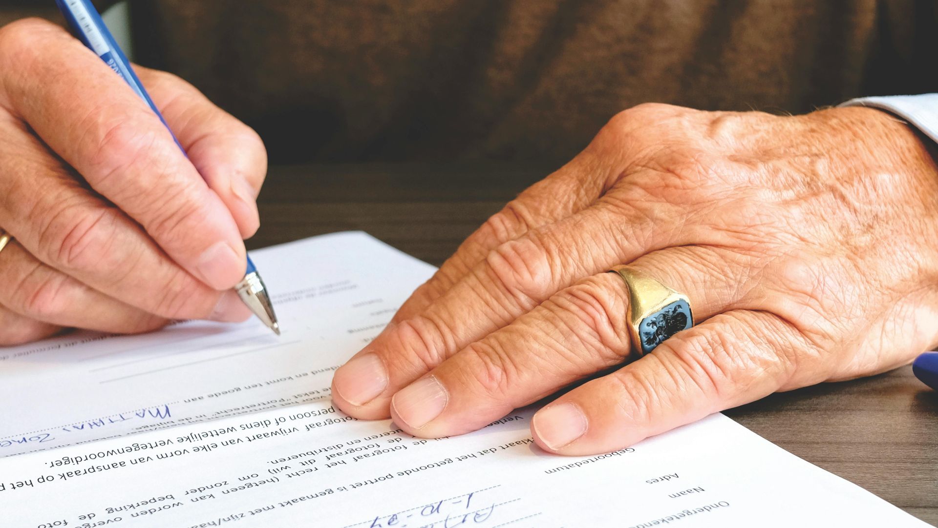
This aspect is critically important and non-negotiable.
If utilizing drone services for commercial purposes in the United States, the drone pilot operating the aircraft must hold a valid FAA Part 107 Remote Pilot Certificate.
Always request proof of this certification before engaging their services; ensure the provider is FAA-approved.
Furthermore, confirm that the provider carries adequate liability insurance specifically covering commercial drone operations or manned aircraft flights.
Accidents, though rare with professional operators, can occur.
Proper insurance protects you, the provider, the public, and property owners should an unforeseen incident during the aerial photography mission.
Being fully insured is a hallmark of a professional service.
Equipment Quality
Inquire about the specific cameras, lenses, drones, or aircraft the provider utilizes for their aerial photography services.
Will their gear work for your project?
Achieving stunning HD resolution for detailed inspections or premium quality cinematic footage requires higher-end gear compared to simple overview shots.
Don't hesitate to discuss technical specifics like camera resolution, sensor capabilities (e.g., thermal imaging accuracy), lens focal lengths, and aircraft flight endurance.
A professional provider should be transparent and knowledgeable about their equipment's capabilities and limitations.
You can count on them for high-quality work—that's what you'll get.
Understanding Your Needs
A reputable provider will invest time to fully understand your specific project goals and requirements.
They should ask pertinent questions about what subjects you need captured, the intended use of the images or data, and any specific shots or angles you have in mind.
Effective communication from the outset helps prevent misunderstandings and ensures the final deliverables meet your expectations.
The provider should also discuss project logistics, including site access requirements, preferred timelines (considering factors like weather), potential airspace restrictions, and any safety considerations.
Working together on the plan keeps the project moving along nicely.
Choose a partner who listens attentively and proactively addresses potential challenges, aiming for fast turnaround where feasible.
Pricing Structure
Obtain clear, detailed pricing information upfront before committing to anything, like commercial real estate photography services.
Understand precisely how the provider structures their fees – whether it's an hourly rate, a fixed project fee, or based on specific deliverables (e.g., number of photos, length of video).
Always inquire about any potential additional costs, such as travel fees (especially if outside their standard service area), image processing or editing charges, or fees for specific data outputs like 3D models.
Here's a simple table comparing drone and manned aircraft for aerial drone photography services:
| Feature | Drones (UAVs) | Manned Aircraft (Plane/Helicopter) |
|---|---|---|
| Cost | Generally Lower | Significantly Higher |
| Altitude | Lower (typically under 400 ft AGL) | Higher (thousands of feet AGL) |
| Flight Time | Shorter (battery dependent, 20-50 mins typical) | Longer (hours) |
| Coverage Area | Smaller per flight | Larger per flight |
| Flexibility | High (tight spaces, close proximity possible) | Lower (requires runway/helipad, altitude limits) |
| Payload Capacity | Lower (limited by drone size/power) | Higher (can carry heavier cameras/sensors) |
| Weather Tolerance | Lower (sensitive to wind/rain) | Higher (can operate in wider conditions) |
| Regulations | Strict (FAA Part 107 for commercial) | Standard aviation regulations (Part 91, etc.) |
The Benefits You Can Expect
Utilizing professional aerial imagery services delivers several compelling advantages beyond just aesthetically pleasing pictures.
Amazing photos from the air and exact data help a lot of different projects.
You get more than photos—you get understanding.
That's what these services offer.
Observing from above provides a deeper understanding than simply being present at ground level.
The context you gain is irreplaceable.
Seeing the big picture from above is really useful.
This helps with large-scale project oversight, like keeping tabs on a building project, and creating stunning marketing materials.
When you see the full context, your decisions get a whole lot better.
Think about it: a doctor needs all the test results, not just one, to treat a patient effectively.
Conclusion
Many businesses can benefit from the incredible visual impact and insightful perspective of overhead views.
Professional & stunning aerial photography services, utilizing either advanced drones or traditional manned aircraft, effectively provide these essential perspectives.
For residential real estate fly-throughs, construction site monitoring, and many other needs, you'll all appreciate how helpful these tools are.
Ready to view your project from new heights?
Contact 1st Choice Aerials today to schedule your aerial photography, inspection, or thermal imaging service!


