
Precision Topographical Mapping Services for Site Planning in Columbus
Planning a new project in Columbus?
Getting a clear picture of the land is the first step.
This means understanding the lay of the land, from hills and valleys to water flow.
Accurate maps help everyone involved, from builders to designers, know what they're working with.
It's all about making sure the project goes smoothly from the start, avoiding surprises down the road.
Using the right tools for topographical mapping services for site planning in Columbus is key to making that happen.
Ready to view your construction project from new heights?
Contact 1st Choice Aerials today to schedule your aerial photography, inspection, or thermal imaging service!
On This Page:
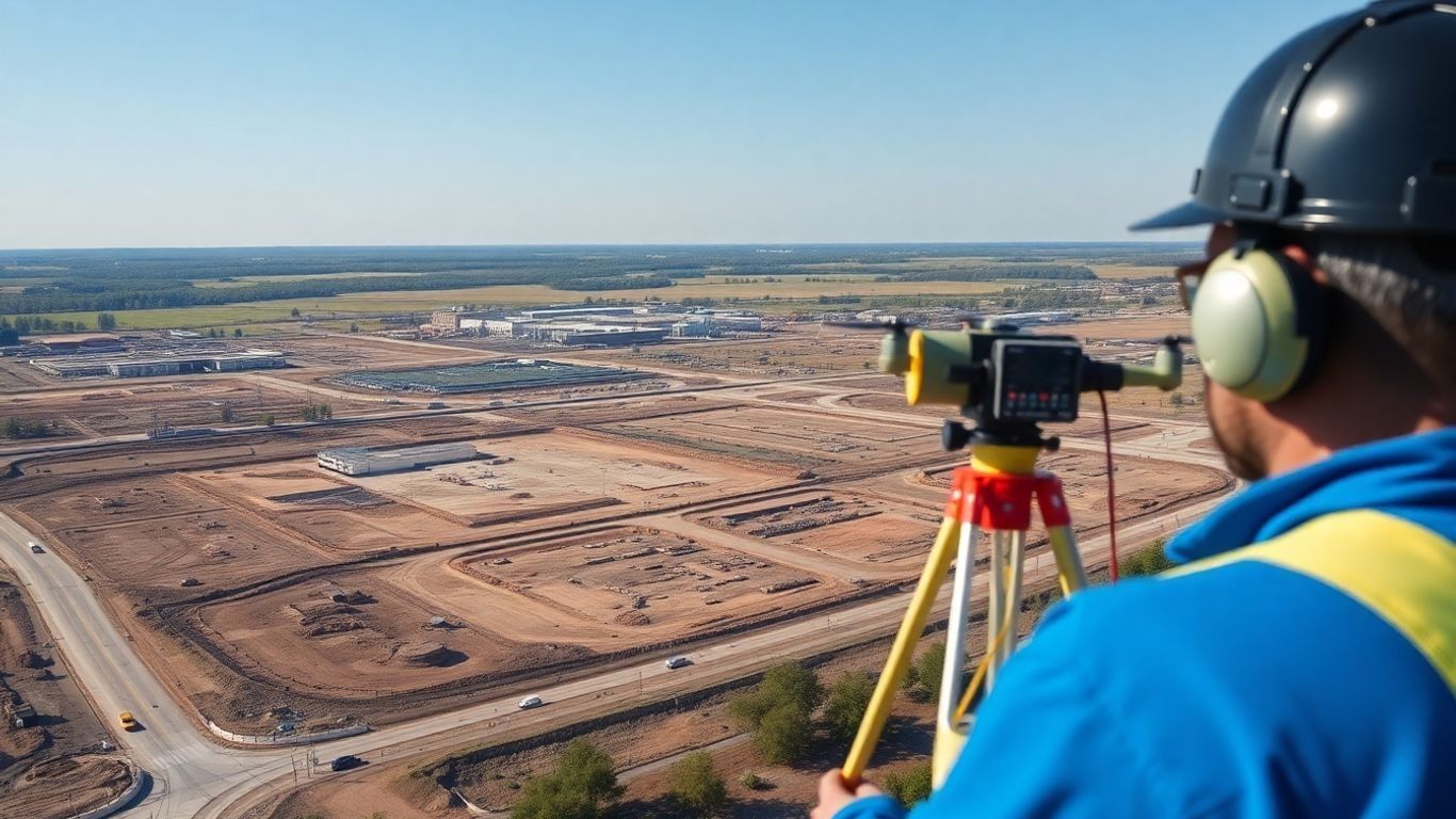
Advanced Surveying Techniques for Site Development
Below are the various techniques and technologies used in topographical mapping for site planning in Columbus, Ohio.
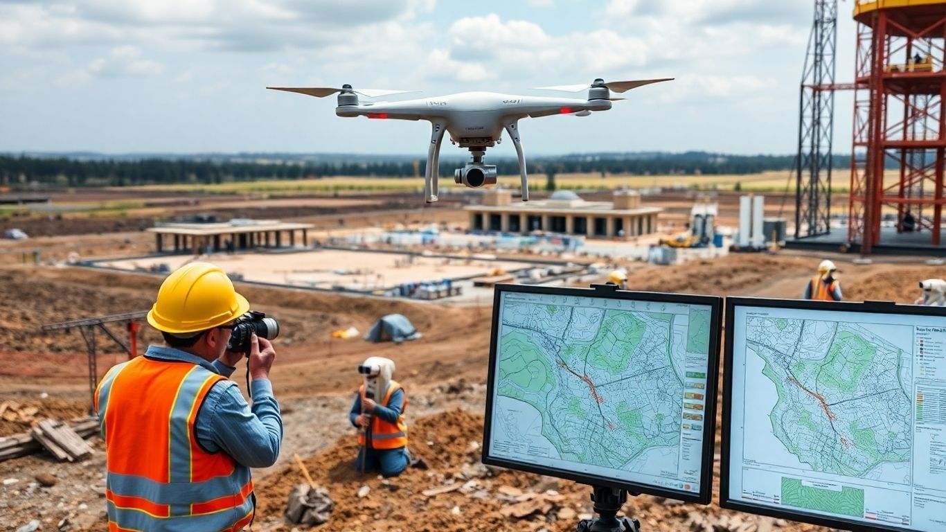
Drone LiDAR Mapping for Enhanced Accuracy
Traditional methods have been around forever, and they work, but technology has really changed the game.
Drone LiDAR mapping is one of those game-changers.
It uses laser pulses to create incredibly detailed 3D terrain models, capturing data with remarkable precision.
This means fewer surprises down the road when you're figuring out grading or drainage.
Drones can also reach places that are difficult or even unsafe for people to reach, collecting data without putting anyone at risk.
While it's not always the perfect solution for every single situation – sometimes dense trees can be a bit of a challenge – it often works best when combined with other survey methods.
Photogrammetry and Aerial Surveying Capabilities
Beyond LiDAR, aerial surveying using photogrammetry is another powerful tool.
This involves taking a bunch of overlapping drone photos and stitching them together using mapping and photogrammetry software to create a detailed map.
It's great for getting a broad overview of a site and can be really useful for tracking progress over time or for visual documentation.
The data you get can be delivered in various formats, like standard image files or CAD drawings, making it easy to plug into your existing project software.
It’s all about getting the right data, in the right format, to help your project move forward smoothly.
Integrating Survey Data with Project Planning
Getting all this detailed survey information is just the first step.
The real magic happens when you integrate it into your project planning.
This data isn't just for show; it directly informs critical decisions.
- Grading and Earthwork: Precise elevation data helps minimize unnecessary soil movement, saving time and money.
- Drainage Systems: Understanding the natural flow of water is key to designing effective stormwater management, preventing future issues.
- Infrastructure Layout: Accurate site maps allow for optimal placement of roads, utilities, and buildings.
- Environmental Assessments: The detailed topography can highlight sensitive areas that need special consideration.
Comprehensive Land Surveying Solutions
Beyond just mapping the lay of the land, a full suite of land surveying services is really what gets a project off the ground correctly.
We're talking about the nuts and bolts that define property, document existing conditions, and prepare for future development.
It’s not just about drawing lines; it’s about providing the legal and physical framework for any construction or development.
Boundary and ALTA/NSPS Land Title Surveys
These surveys are super important, especially for commercial properties and real estate transactions.
An ALTA/NSPS Land Title Survey, for instance, is a big deal when buying or selling property.
It shows property lines, easements, improvements, and any potential encroachments.
It gives buyers and lenders a clear picture of what they're getting into, reducing risks.
This kind of detailed work is often required by title insurance companies and lenders to make sure everything is above board before a deal closes.
It’s a pretty thorough look at the property's legal standing.
Site and As-Built Surveying Services
Once a project is underway or completed, site and as-built surveys are conducted.
A site survey maps the current conditions of a piece of land before construction begins, detailing topography, existing structures, and utilities.
Then, as-built surveys document exactly how a project was constructed, noting any deviations from the original plans.
This is vital for:
- Tracking construction progress accurately.
- Verifying that work meets design specifications.
- Creating a record for future renovations or maintenance.
- Identifying any unexpected site conditions that arose during building.
Property Split and Consolidation Surveys
Sometimes, you need to divide a large parcel of land into smaller lots, or maybe combine several smaller ones into a bigger one.
That's where property split and consolidation surveys come in.
These surveys precisely define the new boundaries for each new parcel or the consolidated area.
This process involves:
- Researching existing property records.
- Performing fieldwork to mark new boundaries.
- Preparing legal descriptions and plats for recording.
This ensures that each new or combined property has clear, legally recognized boundaries, which is essential for sales, development, and taxation purposes.
Getting these details right from the start helps avoid a lot of headaches down the road, especially when dealing with land surveying services in Ohio.
Specialized Mapping for Infrastructure and Utilities
How can drones be used for specialized mapping of infrastructure and utilities?
Utility Mapping and Inventory
When you're planning any kind of construction or development, knowing exactly where underground utilities are is a big deal.
We're talking about water lines, sewer pipes, gas mains, and electrical conduits.
Hitting one of these by accident can cause serious delays, costly repairs, and even dangerous situations.
Our team uses a mix of advanced locating equipment and historical data to create detailed maps showing the precise location of these buried assets.
This isn't just about avoiding a problem; it's about making sure your project stays on track and safe for everyone involved.
We can also help you create an inventory of existing utilities, which is super useful for maintenance and future planning.
Right-of-Way Plan Development
Developing infrastructure often involves working within established rights-of-way, or sometimes, creating new ones.
This process requires careful planning and precise mapping.
We help by developing detailed right-of-way plans that clearly define the boundaries and any easements needed for public access or utility corridors.
This involves:
- Identifying existing property lines and boundaries.
- Determining the necessary width and alignment for the right-of-way.
- Documenting any existing structures or features within the proposed area.
- Preparing legal descriptions and plats for the official record.
Getting this right from the start saves a lot of headaches down the road, especially when dealing with multiple property owners and regulatory bodies.
Solar and Utility Site Mapping
Projects like solar farms and new utility substations need very specific site information.
We provide detailed mapping that supports the design and layout of these complex facilities.
This includes:
- Accurate topographic data for grading and drainage design.
- Mapping of existing infrastructure, like power lines or access roads.
- Analysis of surface areas and slopes for optimal panel or equipment placement.
Supporting Environmental and Land Use Analysis
When you're planning any kind of development, you've got to think about the environment.
Topographical maps provide a clear picture of existing natural features such as streams, slopes, and vegetation.
This data is key for figuring out how your project will fit into the landscape without causing unnecessary disruption.
It helps identify sensitive areas that need protection and plan responsible land use.
For example, understanding the terrain can guide decisions about where to place buildings or roads to minimize impact on natural habitats or water runoff.
This kind of analysis is a key part of ensuring a project is sustainable and meets local regulations.
It's all about working with the land, not just on it.
You can find more details on how these surveys help with land management on pages like topographic surveys for land management.
Partnering for Successful Site Planning in Columbus

Getting a site plan right in Columbus isn't just about having the best survey data; it's about working with the right people.
Think of it like building a house – you need skilled craftspeople, good materials, and a solid blueprint.
For site planning, that means teaming up with folks who know the lay of the land, understand the rules, and can translate your vision into reality.
Collaborating with Developers and Architects
When you're looking to develop a piece of land, developers and architects are usually the first on board.
They're the ones who dream up what the site could become.
But their brilliant ideas need to be grounded in what's actually possible on the ground.
That's where accurate topographical mapping and surveying come in.
We work closely with these teams to make sure their designs are practical and buildable.
This involves:
- Sharing detailed site information: Providing clear elevation data, existing features, and potential challenges.
- Iterative design reviews: Adjusting plans based on survey findings to optimize layout and minimize earthwork.
- Consistent communication: Keeping everyone in the loop as new information arises.
The goal is to create a synergy where design meets reality, preventing costly changes down the line.
It’s about making sure that the beautiful renderings architects create can actually be built efficiently and effectively.
Ensuring Compliance with Local and State Requirements
Columbus, like any city, has its own set of rules and regulations for development.
These aren't just suggestions; they're requirements designed to keep things safe, orderly, and environmentally sound.
Navigating these can be tricky. We help by providing the precise data needed to meet these standards, whether it's for zoning, environmental impact, or building codes.
This often includes:
- Stormwater management plans: Designing systems that handle rainfall according to local ordinances.
- Floodplain analysis: Determining if a site is in a flood-prone area and what that means for development.
- Utility coordination: Mapping existing utilities and planning for new ones in compliance with regulations.
Understanding these requirements from the start saves a lot of headaches.
It's about getting the permits you need without unnecessary delays.
The Role of Local Knowledge in Surveying
While technology gives us incredible precision, there's still no substitute for knowing the area.
Local surveyors understand the nuances of Columbus's terrain, its history, and its specific development patterns.
This local insight is invaluable. It means we're not just looking at numbers on a screen; we're interpreting them within the context of the community.
This helps in:
- Identifying potential site issues: Recognizing subtle drainage patterns or soil conditions common to the region.
- Streamlining the approval process: Knowing which municipal departments to engage with and what information they typically require.
- Providing practical solutions: Offering design recommendations that are proven to work well in the local environment.
Local knowledge combined with advanced surveying techniques creates a powerful advantage for any development project in Columbus.
It bridges the gap between raw data and actionable intelligence, leading to more predictable and successful outcomes.
Wrapping It Up
So, when you're planning a project in Columbus and need to know exactly what you're working with, getting precise topographical maps is a really smart move.
It's not just about looking pretty; it's about having the right info so things go smoothly from the start.
Ready to view your project from new heights?
Contact 1st Choice Aerials today to schedule your aerial photography, inspection, or thermal imaging service!


