Why Drone Mapping Is Growing Fast on Ohio Development Projects
Key Takeaways:
- Ohio is one of the most active construction states in the country, with hundreds of commercial, industrial, and infrastructure projects ongoing statewide
- Drone mapping produces georeferenced 2D maps, 3D site models, and volumetric data that construction teams use for planning, documentation, and reporting to stakeholders
- Aerial mapping is faster, safer, and more repeatable than traditional ground surveying for most site documentation needs
- Commercial drone operations in the U.S. are governed by FAA Part 107, and any provider operating on a commercial job site should be certified and insured
- Working directly with a local Ohio provider means cleaner communication, faster turnarounds, and full accountability from flight to final deliverable
Ohio has a lot going on right now.
Intel's massive semiconductor campus in Licking County. Hundreds of confirmed industrial capital projects statewide in 2024. Major Ohio Department of Transportation rebuilds reshaping corridors from Columbus to Cleveland. And that doesn't include the continuous stream of commercial builds, warehouse developments, and mixed-use projects launching every quarter.
With that level of activity comes real pressure on project teams to document sites faster, communicate progress clearly, and make decisions on accurate data. That's a big part of why drone mapping has gone from a novelty to a standard tool on Ohio development projects over the past several years.
Ohio's Construction Boom Is Demanding Better Site Data
Construction teams have always needed site data. But the old approach, ground crews, manual measurements, and periodic site visits, doesn't always hold up when a project is moving fast and stakeholders want answers now.
According to Industrial SalesLeads, Ohio's industrial sector confirmed 262 new capital projects in 2024 alone, spanning manufacturing, distribution infrastructure, and equipment modernization. Layer in the steady pipeline of ODOT infrastructure work rebuilding highways, bridges, and interchanges across the state, and it's clear this isn't a short-term spike.
Drone mapping fits that environment well. It's fast, repeatable, and produces organized, measurable data that project teams can actually use. For anyone managing tight timelines and multiple active phases on the same job, that's a real operational advantage.
What Drone Mapping Actually Produces
So what does the data actually look like once it's processed? This is where a lot of project managers realize it's more useful than they expected.
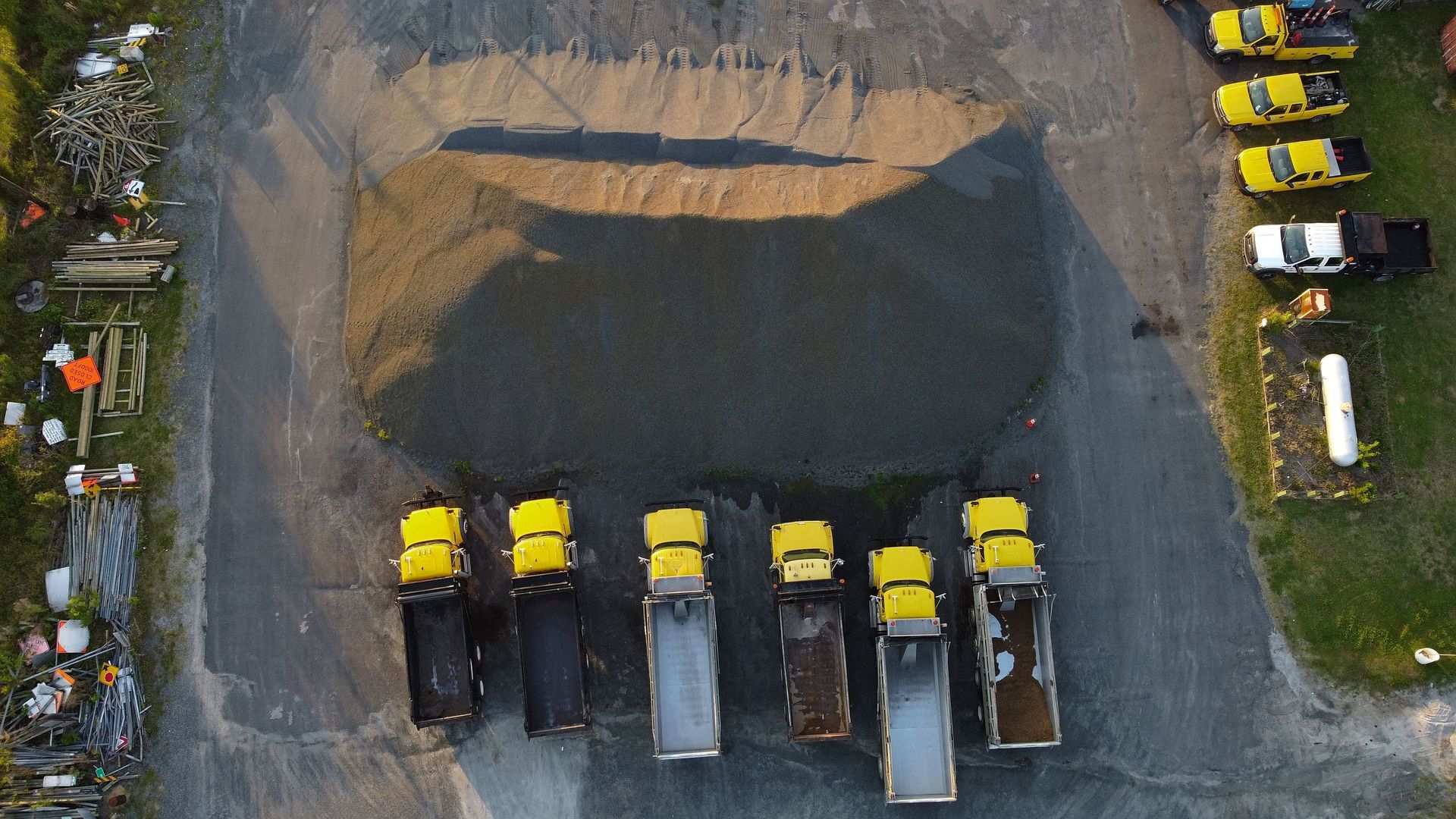
When a drone flies a job site using a structured flight plan, it captures hundreds of overlapping high-resolution images. That raw data is then processed into deliverables, the kind your team can actually open, measure, and share.
Orthomosaic Maps
These are accurate, georeferenced 2D maps stitched together from all captured images. They're high-resolution enough to take measurements directly from the map, verify site layout, and compare conditions over time. Useful at every phase of a project, not just closeout.
3D Surface Models
A 3D model built from drone data lets teams analyze a site from any angle, review grade changes, and understand how the physical terrain relates to the construction plan. It's considerably more practical than waiting on traditional survey crews, especially early in a project when planning decisions are still being made and timelines don't allow for delays.
Volumetric Analysis
One of the more concrete uses for contractors is stockpile and earthwork volume calculation. Drone data can be processed to calculate cut and fill volumes accurately, which helps with budgeting, billing, and material planning. Compared to manual methods, it's faster and doesn't require someone walking through a stockpile with measuring equipment.
Why Construction Teams Are Making the Switch
A few things are driving the shift, and they're all practical.
Faster data capture. Drone surveys cover large sites in a fraction of the time required by ground crews. For commercial and industrial projects in Ohio where weather windows are limited and schedules are fixed, getting accurate site data back quickly is a real operational advantage.
Reduced risk to workers. Some areas of an active job site are difficult or genuinely unsafe to access. Drone mapping lets teams document excavation zones, elevated structures, and unstable ground without putting anyone at risk. It's a benefit that's easy to overlook until you actually need it.
Consistency over time. Good drone mapping isn't just fast. It's repeatable. Flights follow planned paths, images are captured at defined intervals, and the data is processed using consistent workflows. When you fly the same site monthly, you end up with a reliable visual record that's useful for internal reviews, client updates, and project closeout documentation.
How Drone Mapping Fits Into a Real Workflow
Here's something worth considering: drone mapping isn't a replacement for construction expertise. It's a data collection tool that works best when it's built into the workflow a team already uses.
For most commercial and industrial projects, the approach looks something like this. Pre-construction, an initial mapping flight captures baseline site conditions, existing topography, and surrounding features. During active construction, recurring progress monitoring flights document what's been completed, surface discrepancies early, and give project managers and clients a clear visual of where things stand. At closeout, final deliverables support documentation, reporting, and handoffs.
When data is delivered in organized, ready-to-use formats, whether that's orthomosaic files, 3D models, or annotated reports, it fits into BIM workflows, project management platforms, and reporting processes without creating extra work for your team.
Our aerial drone mapping services in Ohio are built around that principle. We focus on delivering data that's organized and usable from the moment it lands in your hands, not raw image files that need sorting before anyone can do anything with them.
FAA Part 107 and Commercial Drone Operations
Commercial drone operations in the United States are regulated under FAA Part 107. This federal rule requires pilots to pass a knowledge exam, register their aircraft, and operate within specific rules covering airspace, altitude, visibility, and other operational parameters.
If you're working with a drone provider on a commercial job site, it's worth confirming they're Part 107 certified and carry commercial liability insurance. Not every operator is. On an active construction site with workers present and third-party liability at stake, that's not a detail to skip.
Our team is fully FAA Part 107 certified and insured. We also hold certifications in construction safety and thermography, which is directly relevant when we're operating alongside other trades on a live job site.
Why the Direct-Provider Relationship Matters
There's a segment of the drone services industry built around broker platforms. A platform wins a job, then passes it to a subcontractor, sometimes two or three layers removed from the original client. Sound familiar? It's more common than most project managers realize, and it creates real problems: communication gaps, inconsistent quality, and turnarounds that stretch longer than anyone quoted.
Working directly with a local Ohio provider means you know who's showing up, what equipment they're using, and who to call if something needs to be adjusted. For active builds with tight schedules and real accountability, that direct relationship is worth prioritizing.
1st Choice Aerials doesn't work through broker platforms or pass projects to subcontractors. Every project is handled directly by our team, from initial flight planning through final data delivery.
Construction Drone Services Across Ohio
Our Ohio construction drone services cover the range of what development projects typically need: pre-construction site surveys, ongoing progress documentation, volumetric analysis, quality control, safety inspections, and stakeholder reporting. We serve commercial, industrial, and infrastructure clients across Ohio, with primary service coverage in Columbus, Dayton, and Cincinnati, and expanding service in Kentucky and Indiana.
If you're managing an active build or planning a new project and want to understand how aerial mapping can support your team, we're glad to talk through the specifics.
Contact us today to request a quote or discuss your project's data needs.
Frequently Asked Questions
What is drone mapping and how is it used in construction?
Drone mapping uses a UAV to systematically photograph a job site, then processes those images into georeferenced 2D maps, 3D surface models, and measurable data. Construction teams use it for site planning, earthwork documentation, progress tracking, and stakeholder reporting across all phases of a project.
How accurate is drone mapping for commercial construction projects?
With RTK-enabled equipment and proper ground control points, drone mapping can achieve high positional accuracy suitable for most commercial applications, including measurements, volumetric calculations, and detailed site documentation. Accuracy depends on equipment, site conditions, and workflow.
What deliverables does a drone mapping project include?
Deliverables typically include orthomosaic maps, 3D surface models, volumetric reports, and annotated imagery. Files are generally provided in formats compatible with common BIM and project management platforms. Specific deliverables are scoped based on the project's needs.
Is drone mapping faster than traditional land surveying?
In most cases, yes. Drone surveys can cover large sites in significantly less time than traditional ground crews require. For Ohio projects where weather windows are limited and schedules are firm, faster data capture has a direct impact on project timelines.
Does a commercial drone operator need FAA certification to work on a job site?
Yes. Commercial drone operations in the U.S. are regulated under FAA Part 107, which requires a certified pilot, registered aircraft, and compliance with operational rules. Always confirm your provider is Part 107 certified and carries commercial insurance before work begins on your site.
How often should drone mapping flights be scheduled on an active construction project?
It depends on the project's scope and your documentation goals. Monthly flights are a common starting point for medium to large builds. Some clients schedule more frequent flights during critical phases. Recurring documentation plans are available for active Ohio sites.
What's the difference between drone mapping and drone photography?
Drone photography produces visual media for marketing or general documentation purposes. Drone mapping involves structured, overlapping image capture that's processed into georeferenced maps and models with measurable data. They use similar equipment but serve very different functions on a construction project.