Stockpile Measurement Best Practices for Ohio Sites
Key Takeaways
- Manual stockpile estimates (tape measures, cone math, eyeballing) are often off by 10 to 20 percent, which adds up fast on aggregate and dirt billing.
- Drone based volumetric measurement uses photogrammetry to build a 3D model of the pile, giving you a number you can actually defend.
- Ground control points and consistent flight altitude matter more than most contractors realize. Skip them and your "accurate" data isn't.
- Measuring on a set schedule (weekly or monthly) catches shrinkage, theft, or vendor discrepancies before they become a real problem.
- Ohio's weather swings mean timing your flights matters. Wet piles, frozen piles, and windblown piles all measure differently.
- Working with a team that flies your site directly, instead of a broker who subcontracts it out, keeps your data chain simple and your numbers consistent job after job.
Getting an Honest Number on What's in the Pile
If you've ever argued with a supplier over how many yards of gravel actually got delivered, you already know why stockpile measurement matters. It's one of those things nobody thinks about until the invoice doesn't match the pile.
We work with contractors and aggregate producers across Ohio, and the same story comes up constantly. Someone walked the pile with a tape measure, ran a cone volume formula in their head, and called it good. That number then gets used for billing, inventory reports, and sometimes even loan draws. The problem? A rough estimate isn't the same thing as a measurement.
Why the Old Methods Fall Short
Cone and frustum formulas assume your pile is a perfect geometric shape. It never is.
Real stockpiles have flattened tops, uneven bases, erosion channels from rain, and material sliding off at different angles. Plug those irregular shapes into a textbook formula and you get a number that looks precise but isn't. Depending on pile size and shape, manual estimates can swing 10 to 20 percent from the true volume. On a large aggregate pile, that gap alone can represent thousands of dollars.
GPS rover surveys are more accurate but slow. Walking a large stockpile with a rover, point by point, takes time your crew probably doesn't have. And if the pile shifts overnight (which it often does), your survey is already out of date by the time you're done.
So what's the alternative? This is where aerial data changes the math entirely.
How Drone Based Volume Measurement Actually Works
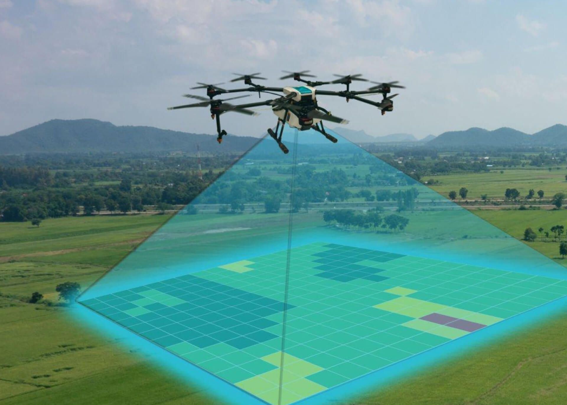
Instead of walking the pile, a drone flies a structured grid pattern above it, capturing dozens or hundreds of overlapping images. Those images get processed into a dense 3D point cloud and a surface model. From there, software calculates the actual volume based on the true shape of the material, not an assumed geometric shape.
This is the same process behind our drone mapping services, where we generate orthomosaic maps and 3D models for construction and industrial sites throughout Ohio. Stockpile analysis is one part of that broader construction drone services offering, which also covers progress tracking, site surveys, and quality control.
A few things separate a usable measurement from a guess dressed up in fancy software:
Ground control points. These are fixed reference markers placed on the ground before the flight, surveyed to known coordinates. Without them, your 3D model can drift, meaning your volume number looks fine but isn't tied to reality.
Consistent flight altitude and overlap. Flying too high reduces resolution. Flying with inconsistent image overlap creates gaps in the model, especially around steep pile edges where most of the volume error tends to hide.
Repeatable timing. If you measure a pile after a heavy rain versus a dry week, moisture content changes the material's compaction and, in some cases, its apparent shape. Comparing numbers across wildly different conditions isn't really an apples to apples comparison.
The ASPRS Positional Accuracy Standards for Digital Geospatial Data lay out the framework the mapping industry uses to define and report positional accuracy for exactly this kind of work. Not every contractor needs to reference the standard directly, but it's worth knowing that "accurate" isn't a marketing word. It's a measurable claim, and it should be backed by a process.
Ohio Specific Considerations
Ohio's weather doesn't make this easy. We go from humid summers to icy winters, sometimes within the same month.
A few things we tell clients to watch for:
Wet or frozen piles can add measurable bulk to a stockpile's apparent volume, especially with fine aggregate or topsoil that holds water. If you're measuring for billing purposes, try to fly during consistent, dry conditions whenever the schedule allows.
Wind matters too. Gusty days common in spring and fall can affect flight stability and, in extreme cases, image quality. A FAA Part 107 certified pilot who understands local conditions will know when to reschedule rather than force a flight that'll produce shaky data.
And don't forget seasonal daylight. Winter flights in Ohio mean a shorter window to work with, which is one more reason scheduling ahead matters more than most people assume.
Building a Measurement Schedule That Actually Works
One-time measurements have their place, especially for a single delivery verification or an end of project audit. But recurring stockpile analysis is where the real value shows up.
Monthly or even weekly flights let you track material drawdown against usage logs. They catch discrepancies between what a hauler reported delivering and what actually landed. They also give you a paper trail if a dispute ever ends up in front of an owner, lender, or auditor.
This ties directly into the kind of progress monitoring services many of our construction clients already use for site documentation. Adding stockpile volumes to a recurring flight schedule doesn't add much cost, since the drone's already on site anyway.
A Note on Who's Actually Doing the Work
Here's something we don't see many competitors talk about. A lot of aerial data companies operate as broker platforms. They win the job, then subcontract it out, sometimes two or three layers deep before an actual pilot ever shows up.
That matters for stockpile measurement more than people realize. If your data is coming from a subcontractor you've never met, using equipment and processing workflows you can't verify, how confident are you really in the number they hand back? We work directly with our clients across Ohio, Kentucky, and Indiana. No middlemen, no layered subcontracts. The person flying your site is accountable to you, not to a broker three steps removed.
Getting Started
Stockpile measurement isn't complicated once you have the right process in place. It just requires consistency: the same flight approach, the same ground control setup, and a team that understands why those details matter.
If your Ohio site is dealing with billing disputes, inventory questions, or just wants a more reliable number than a tape measure can give, that's a conversation worth having.
Ready for Accurate Stockpile Data?
Get in touch with 1st Choice Aerials to schedule a stockpile measurement flight or set up a recurring monitoring plan for your Ohio job site. Contact us today to talk through your project.
Frequently Asked Questions
How accurate is drone based stockpile measurement?
In most cases, drone photogrammetry with proper ground control can produce volume measurements within a few percentage points of true value, far tighter than manual cone estimates. Accuracy depends on flight planning, ground control setup, and site conditions on the day of the flight.
How often should stockpile volumes be measured?
It depends on how the pile is used. Sites tracking material drawdown or billing disputes often benefit from monthly or even weekly flights. A single audit flight may be enough for one-time delivery verification.
Do I need ground control points for every stockpile flight?
Generally speaking, yes, if you need defensible numbers for billing, legal, or audit purposes. Ground control points tie the 3D model to real world coordinates and reduce drift in the final measurement.
Can weather affect stockpile measurement accuracy?
Yes. Rain, snow, and standing water can change a pile's apparent shape and volume. Wind can also affect flight stability and image quality. Scheduling flights during stable, dry conditions produces more reliable results.
What's the difference between stockpile measurement and construction progress mapping?
Stockpile measurement focuses specifically on calculating the volume of a material pile. Construction progress mapping covers a broader picture, tracking earthwork, site changes, and overall project development over time. Many contractors use both together.
Is stockpile measurement only useful for aggregate producers?
Not at all. Construction contractors, demolition companies, and property owners managing fill dirt, debris, or raw materials all use volumetric data for planning, billing, and inventory control.
How do I get started with drone stockpile measurement in Ohio?
Reach out with details about your site and how often you need measurements taken. From there, a flight schedule and ground control plan can be set up based on your project's specific needs.
This article is for general educational purposes and does not constitute engineering, surveying, or legal advice. Measurement accuracy depends on site conditions, equipment, and workflow. Contractors with billing, contractual, or regulatory questions tied to material volumes should consult a licensed surveyor or engineer as needed.