Stockpile Measurement With Drones vs Traditional Survey Methods
Key Takeaways:
- Drone photogrammetry achieves stockpile volume measurement accuracy of 2-5% when properly executed, matching or exceeding traditional surveying methods in most applications
- Traditional surveying methods like total stations and GPS require workers to climb stockpiles or traverse hazardous terrain, creating significant safety risks that drones eliminate entirely
- Drone surveys capture comprehensive stockpile data in hours rather than days, reducing labor costs by 60-70% compared to traditional ground-based measurement approaches
- Modern drone technology with RTK positioning delivers centimeter-level accuracy without requiring extensive ground control point networks that traditional methods depend on
- The combination of speed, safety, and accuracy makes drone-based volumetric analysis particularly valuable for operations managing multiple stockpiles across large sites
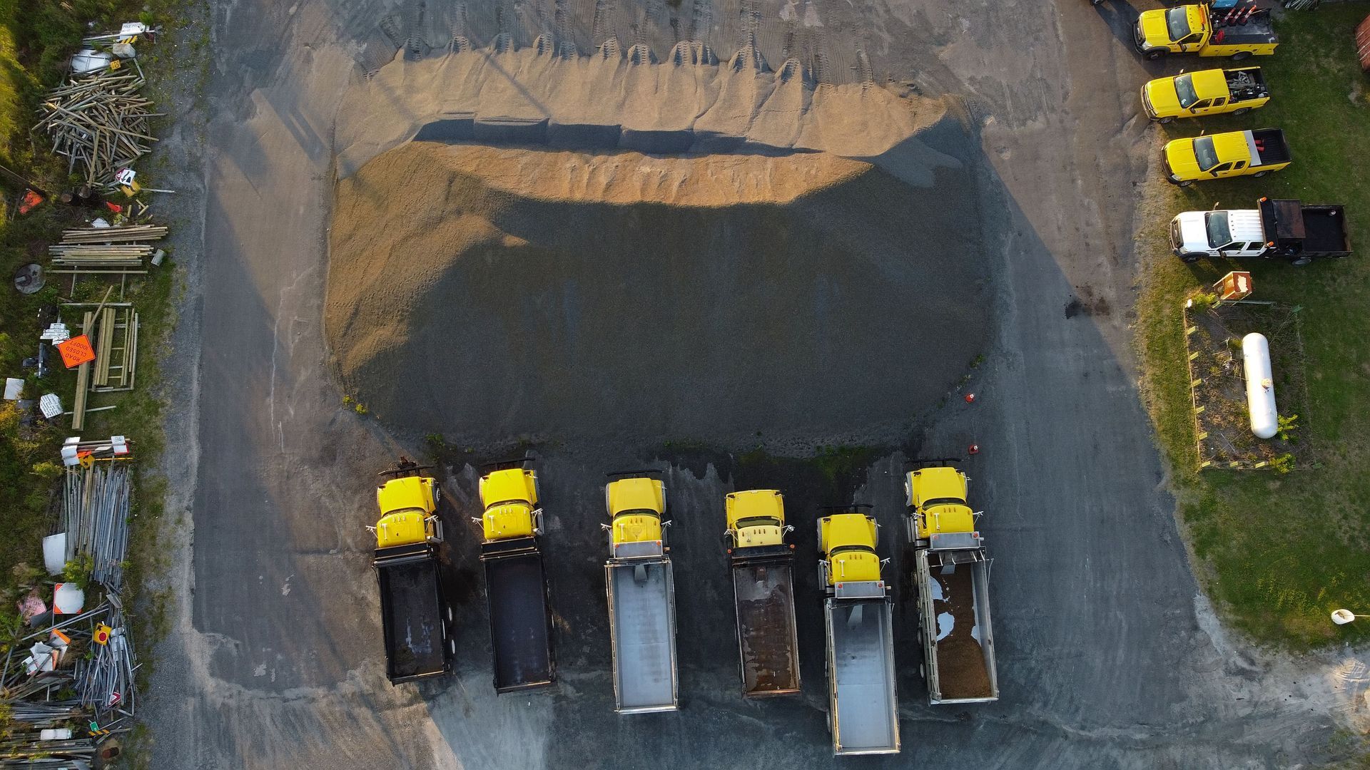
Stockpile inventory management represents one of the most critical yet challenging aspects of running construction sites, quarries, and aggregate operations. Knowing exactly how much material you have on hand impacts everything from financial reporting to production planning. At 1st Choice Aerials, we work with operations throughout Ohio that previously relied on traditional surveying methods for stockpile measurements. The shift to drone-based volumetrics has transformed how these companies track inventory, and the differences between old and new approaches are substantial.
Understanding the strengths and limitations of each measurement method helps operations managers make informed decisions about their inventory tracking processes. Let us walk you through what we have learned working with both traditional and modern approaches to stockpile measurement.
How Traditional Stockpile Measurement Methods Work
Before drones became widely adopted in the construction and mining industries, stockpile measurement relied on several established methods. Each approach has its place, but they all share common limitations that have become more apparent as drone technology has advanced.
Total Station Surveys
Total stations represent the traditional gold standard for surveying work. These sophisticated instruments combine electronic theodolites with electronic distance measurement capabilities to capture precise angle and distance data. According to research published in Drones journal, total stations can achieve distance accuracies of 1mm plus 1ppm (parts per million), making them highly precise tools.
For stockpile measurement, surveyors use total stations to capture points around and across the pile. They walk the perimeter, climb the stockpile, and measure numerous points to create a profile of the material. Software then interpolates between these measured points to estimate volume.
The challenge with this approach lies in what happens between the measured points. A surveyor might capture 50 or 100 points across a stockpile, but the actual surface contains thousands of subtle variations. The accuracy of the final volume calculation depends heavily on how many points get measured and how well those points represent the actual stockpile shape.
GPS and GNSS Methods
Global Navigation Satellite System receivers offer another traditional approach to stockpile measurement. Surveyors equipped with GPS units walk stockpiles, collecting coordinate data at regular intervals. Real-Time Kinematic positioning can achieve centimeter-level accuracy under ideal conditions.
However, GPS-based methods face inherent limitations. The technology works through line of sight to satellites, meaning signal quality varies based on atmospheric conditions, nearby structures, and even the time of day. Dense stockpile materials can also create multipath errors where GPS signals bounce off surfaces before reaching the receiver, degrading accuracy.
Like total stations, GPS methods rely on collecting individual points and interpolating between them. A surveyor might spend hours walking a large stockpile site, and the final accuracy still depends on adequate point density across irregular surfaces.
Manual Measurement and Estimation
Some operations still rely on manual measurement techniques or estimation methods. Walking wheels measure perimeter distances, tape measures capture heights, and formulas based on cone or pyramid shapes provide rough volume estimates. These approaches work for simple, regularly shaped piles but fail when dealing with irregular stockpiles or complex site conditions.
The least reliable traditional method involves visual estimation or "eyeballing" volumes. While experienced materials managers can make educated guesses, this approach introduces substantial error that compounds across multiple stockpiles or repeated measurements over time.
How Drone Stockpile Measurement Works
Drone-based volumetric surveying represents a fundamentally different approach to stockpile measurement. Instead of collecting individual points, drones capture complete surface models through photogrammetry or LiDAR technology.
Photogrammetry Process
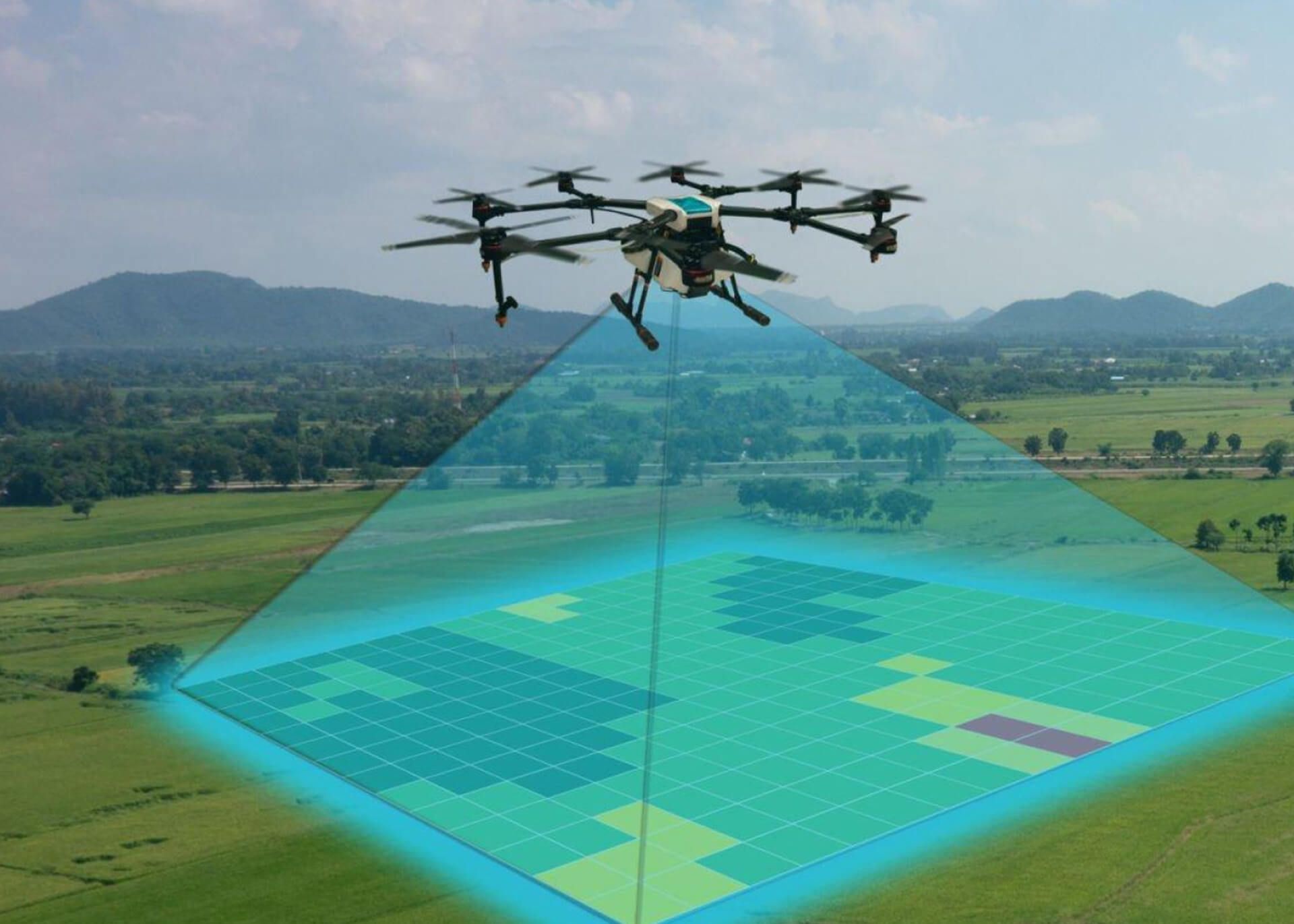
The photogrammetry workflow begins with flying a drone in a systematic pattern over the stockpile area. The drone captures overlapping images from multiple angles, typically achieving 70-80% overlap between adjacent photos. These images get processed through specialized software that identifies common features across multiple photographs and uses those matches to reconstruct the three-dimensional surface.
Modern photogrammetry software creates dense point clouds containing millions of data points representing the stockpile surface. Rather than interpolating between measured points like traditional methods do, photogrammetry directly measures nearly every visible point on the surface. This comprehensive coverage captures surface irregularities and features that point-based methods miss.
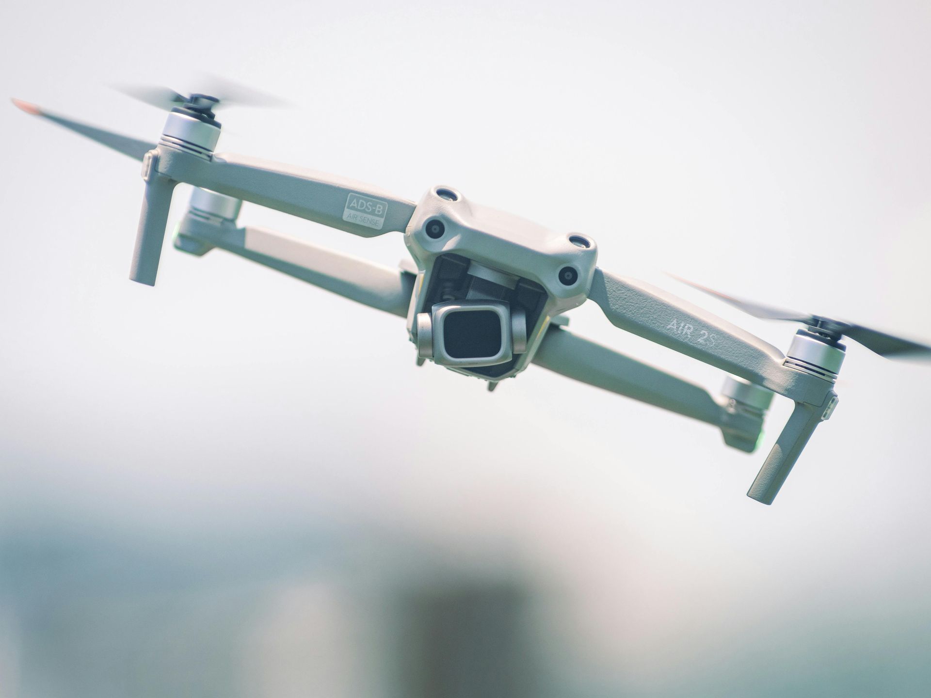
At 1st Choice Aerials, we utilize high-resolution cameras and RTK positioning on our drones to capture imagery that produces accurate 3D models. The RTK positioning embeds precise GPS coordinates directly into each photograph, eliminating or reducing the need for extensive ground control point networks that traditional methods require.
LiDAR Technology
Light Detection and Ranging offers an alternative drone-based approach particularly useful in challenging conditions. LiDAR sensors emit laser pulses and measure how long the light takes to return after bouncing off surfaces. This active sensing technology works in low-light conditions and can penetrate vegetation to capture underlying terrain.
For stockpile measurement, LiDAR excels at capturing vertical surfaces and complex geometries that photogrammetry might struggle with. The technology generates extremely dense point clouds with consistent point spacing regardless of surface texture or lighting conditions. Our construction services often incorporate LiDAR when projects involve heavily vegetated areas or stockpiles with challenging visual characteristics.
Accuracy Comparison: Drones vs Traditional Methods
Accuracy represents the primary concern when comparing stockpile measurement methods. Inaccurate volume calculations lead to inventory discrepancies, financial write-offs, and operational inefficiencies.
Research comparing different measurement approaches has demonstrated that drone photogrammetry can achieve volumetric accuracy within 2-5% of true volumes when proper procedures are followed. Some studies report accuracy levels of 98-99% for drone-based measurements compared to reference volumes. These figures match or exceed what traditional methods typically achieve in field conditions.
The key difference lies not just in final accuracy but in consistency. Traditional point-based methods achieve high precision at each measured location but depend on the surveyor collecting enough points in the right locations. Human factors like fatigue, time pressure, and safety concerns affect point collection patterns. A surveyor rushing to complete measurements before weather changes might skip areas or reduce point density, degrading overall accuracy.
Drone photogrammetry captures comprehensive surface coverage regardless of time pressure or site conditions. The drone follows programmed flight paths that ensure consistent image overlap and coverage. Weather affects when flights can occur, but once the drone launches, it captures complete data across the entire stockpile area with uniform density.
Ground control points do improve drone survey accuracy, particularly for absolute positioning. However, modern RTK-equipped drones achieve remarkable accuracy even without extensive ground control networks. For relative measurements like stockpile volumes where the interest lies in material quantity rather than precise geographic position, RTK drones deliver excellent results with minimal ground preparation.
Safety Considerations in Stockpile Measurement
Traditional stockpile measurement methods expose workers to significant hazards. Climbing stockpiles of loose aggregate, coal, gravel, or other materials presents obvious fall risks. Materials can shift unexpectedly, creating additional instability. In active operations, heavy equipment moving near stockpiles creates struck-by hazards for surveyors working in the area.
Weather compounds these risks. Surveyors often face pressure to complete measurements despite heat, cold, or marginal conditions because operations need current inventory data. Working on slopes in wet or icy conditions multiplies fall hazards. Yet operations cannot simply stop measuring stockpiles when conditions are less than ideal.
Drone-based measurement eliminates worker exposure to these hazards. The pilot operates from a safe distance while the drone captures data remotely. Weather still affects flight operations, but the concern shifts from worker safety to equipment protection and data quality. Rain or high winds might prevent flights, but no one climbs a wet stockpile in those conditions anyway.
The safety advantage extends beyond the obvious physical hazards. Traditional methods require surveyors to traverse entire sites, potentially crossing active haul roads or working near moving equipment. Reducing time personnel spend on site reduces overall exposure to the numerous hazards present in construction and mining environments.
When we deploy our drone services for stockpile measurement, site operations continue without interruption. Equipment keeps moving, production continues, and workers remain in safe areas while the drone captures comprehensive data overhead.
Time and Cost Efficiency Analysis
The economics of stockpile measurement involve direct costs like equipment and labor, plus indirect costs associated with downtime, safety incidents, and measurement frequency.
Traditional surveying methods are labor-intensive and time-consuming. A two-person crew might spend an entire day measuring stockpiles across a medium-sized quarry site. Larger operations with numerous stockpiles require multiple days of work. Survey crews typically charge $2,500 to $5,000 or more per site visit, and that cost recurs with each measurement cycle.
Beyond direct surveying costs, traditional methods create operational impacts. Surveyors working on stockpiles mean equipment must work around them or stop entirely for safety. These interruptions reduce productivity and can delay critical operations.
Drone surveys dramatically reduce measurement time. What takes ground crews days to measure, drones capture in hours. A drone can fly an entire quarry in a single morning, capturing data for all stockpiles during that time. Processing the imagery takes additional time, but that work happens in the office without affecting site operations.
The time savings translate directly to cost reductions. Drone surveys typically cost significantly less than traditional surveying, and the reduced site time means virtually zero operational disruption. Equipment continues working, production flows without interruption, and the measurement data arrives faster.
Perhaps more significantly, the reduced cost and time enable more frequent measurements. Traditional methods are expensive enough that many operations measure stockpiles monthly or even quarterly. With drone surveying, weekly or even daily measurements become economically feasible. More frequent data means better inventory accuracy, improved production planning, and earlier detection of inventory discrepancies.
Practical Considerations for Implementation
Choosing between traditional and drone-based stockpile measurement involves evaluating several practical factors beyond pure technical capabilities.
Site characteristics influence which approach works effectively. Traditional methods work anywhere a surveyor can safely access. Drones require adequate airspace and face restrictions near airports or in urban areas with flight limitations. However, drones excel in precisely those situations where surveyor access is most dangerous or difficult, like tall stockpiles, unstable materials, or active sites with heavy equipment traffic.
Measurement frequency needs affect the economics. Operations requiring infrequent measurements might find traditional surveying adequate. The fixed costs of establishing drone programs or contracting drone services make more sense for operations needing regular, repeated measurements.
Regulatory requirements also factor into decisions. Some operations must maintain certified survey-grade accuracy for regulatory reporting. Understanding whether drone-derived volumes meet regulatory standards in specific jurisdictions requires careful evaluation. In most cases, properly executed drone surveys provide accuracy sufficient for regulatory purposes, but verification of compliance remains important.
Environmental conditions affect both approaches but differently. Traditional surveys struggle in extreme heat or cold that stress workers. Drones cannot fly safely in high winds or precipitation. Understanding seasonal conditions and planning measurement schedules accordingly helps maintain consistent data collection regardless of chosen method.
Integration With Operations and Reporting
The value of stockpile measurement extends beyond knowing current volumes. Operations need to track changes over time, compare actual usage against projections, and integrate inventory data with broader business systems.
Traditional survey data typically arrives as point files or calculated volume figures. Integration with other systems requires manual data entry or custom processing workflows. The discrete nature of traditional measurement events means operations work with point-in-time snapshots rather than continuous tracking.
Drone-based measurement generates rich datasets that support sophisticated analysis. The same flight that captures stockpile data also documents site conditions, equipment locations, and progress on ongoing work. This comprehensive documentation creates value beyond the primary volume measurement purpose.
Modern photogrammetry platforms provide visualization tools that help stakeholders understand inventory status and changes. Rather than reviewing spreadsheets of volume figures, managers can view 3D models, compare current conditions against previous surveys, and virtually inspect stockpiles from any angle. This visual context improves decision-making and communication.
At 1st Choice Aerials, we process drone data into formats that integrate smoothly with common business systems. Exportable volume reports, time-series comparisons, and comprehensive documentation support both daily operations and longer-term planning activities.
Making the Right Choice for Your Operation
No single measurement approach suits every operation. The right choice depends on site-specific factors, operational requirements, and broader business objectives.
Operations managing a small number of stockpiles with infrequent measurement needs might find traditional methods adequate. The simplicity of bringing in a survey crew occasionally outweighs the benefits of establishing drone capabilities for limited use.
Medium to large operations with multiple stockpiles, active production, and frequent measurement requirements gain substantial value from drone-based approaches. The improved safety, reduced operational disruption, and ability to measure more frequently create compounding benefits that quickly justify investment in drone capabilities.
Understanding available options helps operations make strategic decisions. Contracting external drone service providers offers access to capabilities without capital investment in equipment or training. For operations with sustained needs across multiple sites, developing internal drone programs provides long-term cost advantages and operational flexibility.
The construction industry throughout Ohio includes diverse operations with varying stockpile measurement needs. From aggregate producers managing materials at multiple quarries to construction companies tracking materials across project sites, the specific requirements differ substantially. Evaluating methods based on actual operational needs rather than generic comparisons leads to solutions that deliver real value.
Partner With Professionals Who Understand Your Needs
Accurate stockpile measurement supports sound business decisions, regulatory compliance, and operational efficiency. Whether you choose traditional methods, drone-based approaches, or a combination of both, working with knowledgeable professionals ensures you get reliable data that meets your specific requirements.
1st Choice Aerials brings expertise in construction, engineering, and surveying to every project we undertake. We understand that stockpile measurement is not just about flying drones and generating volume numbers. It is about providing actionable data that helps operations run more efficiently and safely. Our team takes the time to understand your measurement requirements, site conditions, and business objectives so we can recommend solutions that truly fit your needs.
If your operation relies on accurate stockpile inventory data and you are curious whether modern drone technology might improve your measurement processes, we would be happy to discuss your specific situation.
Contact our teamto learn more about how we help operations throughout Ohio track inventory more accurately, safely, and cost-effectively through professional drone-based volumetric services.