More Efficient Builds: Aerial Progress Photos Construction Projects
Huge construction projects require significant oversight.
There are many moving parts, schedules to adhere to, and stakeholders who want updates.
What if there were a better way to regularly and accurately see what is happening on your job site?
Imagine seeing your construction project from above!
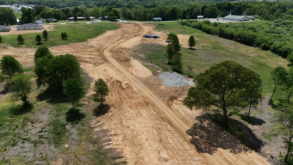
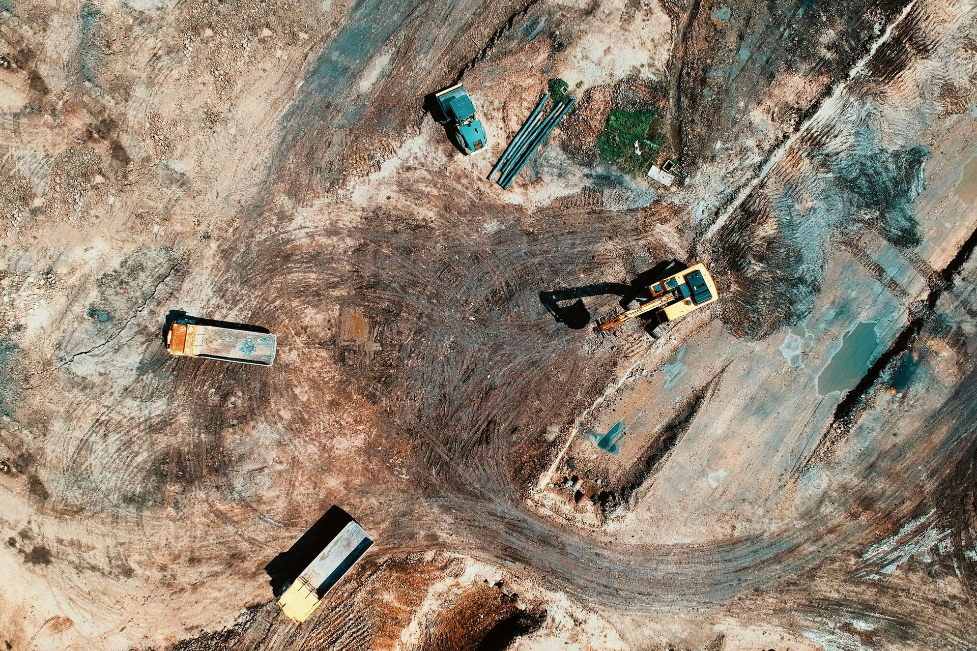
Aerial progress photos give site managers and developers a bird's-eye view, making progress monitoring much easier and more efficient.
Ready to view your construction project from new heights?
Contact 1st Choice Aerials today to schedule your aerial photography, inspection, or thermal imaging service!
On This Page:
What Exactly Are Aerial Progress Photos for Construction Projects?
Aerial progress photos are high-resolution images taken from aircraft, commonly drones.
High-flying photos show your construction site from all angles.
You get a great overall view.
Attractive images are secondary; the primary focus is on amassing critical data for construction oversight.
Regular monitoring ensures everything stays on track and within budget.
Consider traditional methods for a moment, where someone might walk the site, take ground-level photos, and make notes.
While this has its place, it is time-consuming and can miss the big picture that aerial views provide.
Aerial views give you a complete overview in one go.
Benefits of Aerial Progress Photos for Construction Projects
Big projects get a real boost from aerial imagery.
You might be surprised by how much difference a bird's eye perspective can make.
So, what are the perks of using aerial photography for construction?
Here's the lowdown.
Improved Project Monitoring and Tracking
One of the biggest pluses is how much better you can monitor everything involved in your construction progress.
With regular flights, you get a consistent visual record of your construction progress aerial documentation.
You can literally watch your project come to life week by week or month by month using these aerial photos.
Regular updates keep your projects on track, financially and time-wise.
You can quickly see if things are falling behind or if certain areas are moving faster than expected.
Additionally, if problems are starting to pop up, like material storage issues or incorrect groundwork, they are often much easier to spot from above.
Enhanced Communication and Collaboration
Construction projects involve many people: clients, investors, architects, engineers, and subcontractors.
Keeping all team members on the same page can be challenging.
Using aerial photos makes all the difference; the whole process becomes simpler and more efficient.
Clear, visual updates from construction aerial efforts are easy for anyone to understand, regardless of their technical background.
Imagine sending your client a crisp aerial shot showing the latest developments instead of just a written report; it's a powerful communication tool.
The method fosters confidence and maintains engagement, proving incredibly valuable for real estate ventures of all sizes, especially large commercial projects.
It is also great for remote teams or stakeholders who cannot visit the job site often.
They can still get a very real sense of how things are going, fostering better teamwork.
Cost Savings and Efficiency

Every construction company wants to save money and get things done faster.
Aerial progress photos contribute to that goal significantly.
Fewer detailed manual site inspections mean reduced labor costs and less time spent walking the site, which is a direct saving.
When you can spot potential issues early from the air using drone construction progress methods, you can fix them before they escalate into costly rework.
Better progress tracking, aided by regular construction progress aerial views, means better resource allocation.
Increased Safety on Site
Safety is a huge concern on any construction site.
Drones, as part of a drone construction strategy, can help make your site safer.
They can inspect hard-to-reach or hazardous areas, like rooftops, high scaffolding, or unstable ground, without putting a person at risk.
Safety hazards?
Aerial photography can help you identify them easily and meet OHSA standards.
A bird's-eye view often reveals things you'd miss on the ground.
Examples include improperly stored materials or unsafe access points, which can then be addressed proactively.
Superior Documentation and As-Built Records
Having a complete visual history of your project is incredibly valuable for any construction company.
Construction photography needs good aerial photos.
These photos build a detailed, up-to-date record of the building process.
This timeline of quality images shows exactly how the project was constructed from start to finish.
This documentation will be really helpful if you ever have a disagreement about the finished project.
You have clear evidence of the site's condition at specific points in time from your progress aerial photography.
Beyond that, these records are also useful for future maintenance or if you plan similar larger projects down the line, as you have a rich visual database to learn from.
Good record keeping is a lifesaver for project handoffs, too; you'll be glad you did it!
How Do Aerial Progress Photos of Construction Projects Work?
It sounds great, but what is actually involved in getting these aerial progress photos construction projects off the ground?
It is generally a three-step process: planning, data capture, and then processing and delivery.
Let us break that down to understand how a construction aerial photography service operates.
The Planning Phase

Good results start with good planning.
Before any drone takes to the sky for a drone project, youneed to define what you want to achieve.
Which parts of the construction site need the closest watching?
What information are you trying to get from the aerial photos?
Next comes flight path planning.
For consistent progress monitoring, flight paths are often automated using specialized software.
The drone follows the same path every time, so you get similar pictures for each survey.
It all starts with a plan: waypoints, altitudes, and camera angles—all carefully considered to get the best possible footage.
Safety and legal stuff? Super important.
Drone operators must follow regulations, like those set by the Federal Aviation Administration (FAA) in the US.
These cover where you can fly, when you can fly, and what permits you need.
Airports and secure areas have extra regulations.
The Data Capture Phase
This is when the drone goes to work.
A certified drone pilot will operate the aircraft on site, ensuring all safety protocols are followed.
They will execute the pre-planned flight paths to capture the necessary images or progress videos.
Oblique photos are taken at an angle and show the sides of structures, giving a more 3D perspective, which is useful for detailed inspection of vertical elements.
Video fly-throughs are also popular for a dynamic view, often used in presentations or for social media.
The frequency of these flights for construction progress aerial photography depends on your project needs.
It could be weekly for fast-paced commercial real estate projects, bi-weekly, or monthly for longer-term developments.
The Processing and Delivery Phase
Once the images are captured by the drone construction team, they need to be processed.
This often involves specialized software that can stitch thousands of individual high-resolution aerial photos together.
This creates large orthomosaic maps or detailed 3D models of the job site.
These processed site photos might also be annotated with notes, measurements, or comparisons to previous surveys.
The final deliverables can vary based on the construction company's needs.
You might get a set of high-resolution JPEGs, detailed PDF reports with before-and-after comparisons of construction progress, or access to an online platform.
Choosing the Right Drone Service Provider for Your Project
Not all drone service providers offer the same level of expertise or quality of aerial photography.
If you are looking to use aerial progress photos for your construction project, you need to pick the right partner.
What should you look for in a provider of construction aerial photography?
A provider who understands construction sites, their inherent challenges, and your specific needs for monitoring construction will be much more valuable than a general aerial photographer.
Ask to see their portfolio, focusing on examples of progress aerial work and any case studies related to construction projects, particularly larger projects if applicable.
Licensing and insurance are non-negotiable elements for any drone project.
To operate commercially, the operator must have the proper FAA certifications, such as a Part 107 license in the US.
They also need to carry adequate liability insurance specifically for commercial drone operations, protecting your construction company from unforeseen incidents.
Discuss their equipment and software capabilities.
Do they have drones and cameras capable of capturing the high-resolution detail you need for accurate site photos and progress videos?
What software do they use for processing data and generating deliverables like orthomosaics or 3D models?
Check if their technology meets your project needs.
Reliability and clear communication matter a lot too.
You want a provider who listens to your needs, explains their process for progress aerial photography clearly, and is responsive to your questions.
The Future of Aerial Imagery in Construction

The use of aerial progress photos construction projects is already making a big impact, but what is next?
The technology supporting construction aerial photography is constantly improving.
We'll see even better ways to run huge construction projects; new apps will make a big difference.
Connecting more deeply with Building Information Modeling (BIM) is really interesting.
Imagine overlaying your drone-captured reality data, the high-resolution aerial photos and 3D models, directly onto your 3D BIM models.
This allows for very precise comparisons of as-built versus as-designed conditions, spotting deviations early and accurately during the monitoring construction phase.
Some platforms are already offering aspects of this, making the bird's-eye view even more analytical.
Site photos are now being analyzed more and more with the help of artificial intelligence and machine learning.
AI could automatically analyze aerial images to count materials like pipes or lumber, track the movement and utilization of heavy equipment, or even identify potential safety hazards without human intervention.
Using drones to monitor construction provides faster progress reports, which improves project management and automation.
Drones are also getting upgraded with advanced sensors.
Drones aren't just for high-resolution pictures.
They can also use thermal cameras to spot problems like leaks, faulty wiring, or heat escaping. LiDAR (Light Detection and Ranging) sensors can create extremely accurate 3D maps and point clouds of the job site.
Multispectral sensors can assess vegetation health for landscaping or environmental compliance aspects of a drone project.
With these sensors, the possibilities for data are endless!
We can collect and analyze so much more now.
Real-time data streaming from drones directly to project managers on site or in the office could also become more common.
Conclusion
Construction projects of all sizes—from modest homes to massive commercial developments—greatly benefit from aerial progress photos.
Job site monitoring is safer, more efficient, and clearer than ever before.
The benefits are clear and compelling.
From keeping team members and stakeholders happy with visual updates of construction progress to catching problems before they balloon into costly fixes, the benefits are clear and compelling.
This allows for informed decision-making and ultimately better outcomes.
Ready to view your project from new heights?
Contact 1st Choice Aerials today to schedule your aerial photography, inspection, or thermal imaging service!


