How 1st Choice Aerials Can Assist in Flood Relief Efforts and Help Protect Infrastructure Following Recent Rainfall in Ohio and Kentucky
This is a subtitle for your new post
Introduction
Ohio has been hit hard this season with heavy rainfall—and more is on the way. As creeks rise and fields flood, communities across the state are facing increasing challenges. At 1st Choice Aerials, we specialize in providing cutting-edge drone disaster response services to help Ohio residents, emergency teams, and local governments stay ahead of the storm.
Whether it's real-time flood mapping, infrastructure inspection, or post-disaster assessments, our fleet of advanced drones is ready to serve when the waters rise.
1. Real-Time Flood Mapping with Drones
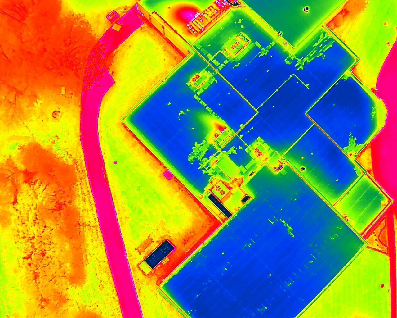
When flooding starts, time is everything. Our flood mapping drones deliver high-resolution aerial views of rising water levels, helping emergency managers make quick, informed decisions. 1st Choice Aerials uses both RGB and thermal sensors to create real-time flood maps across Ohio’s urban areas, farmland, and backroads.
- With drone flood mapping, you can:
- Monitor flash flood zones
- Identify blocked waterways and overflow
- Track flood spread in real-time
This is especially crucial in rural Ohio, where access can be limited and water can cover large areas fast.
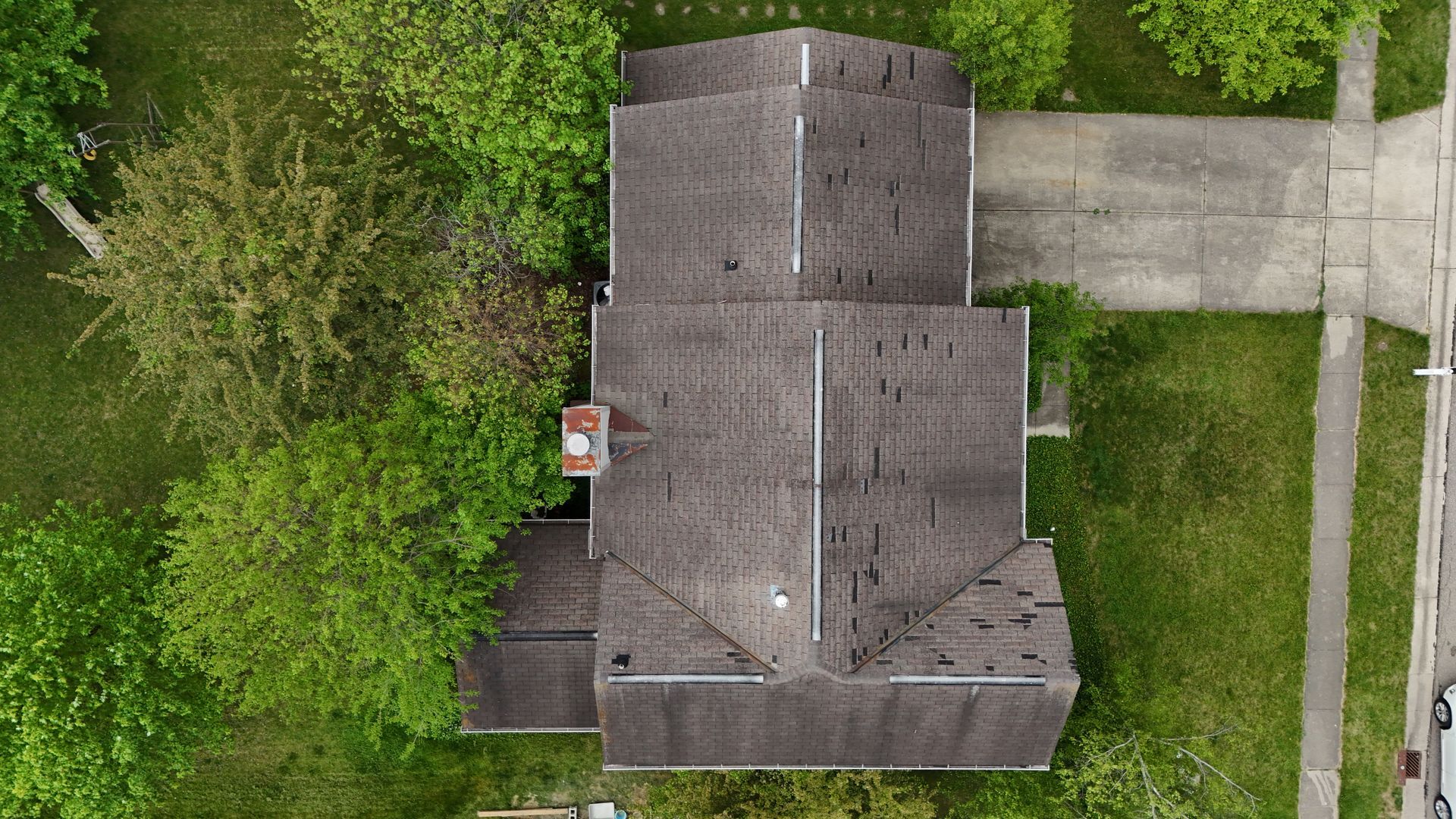
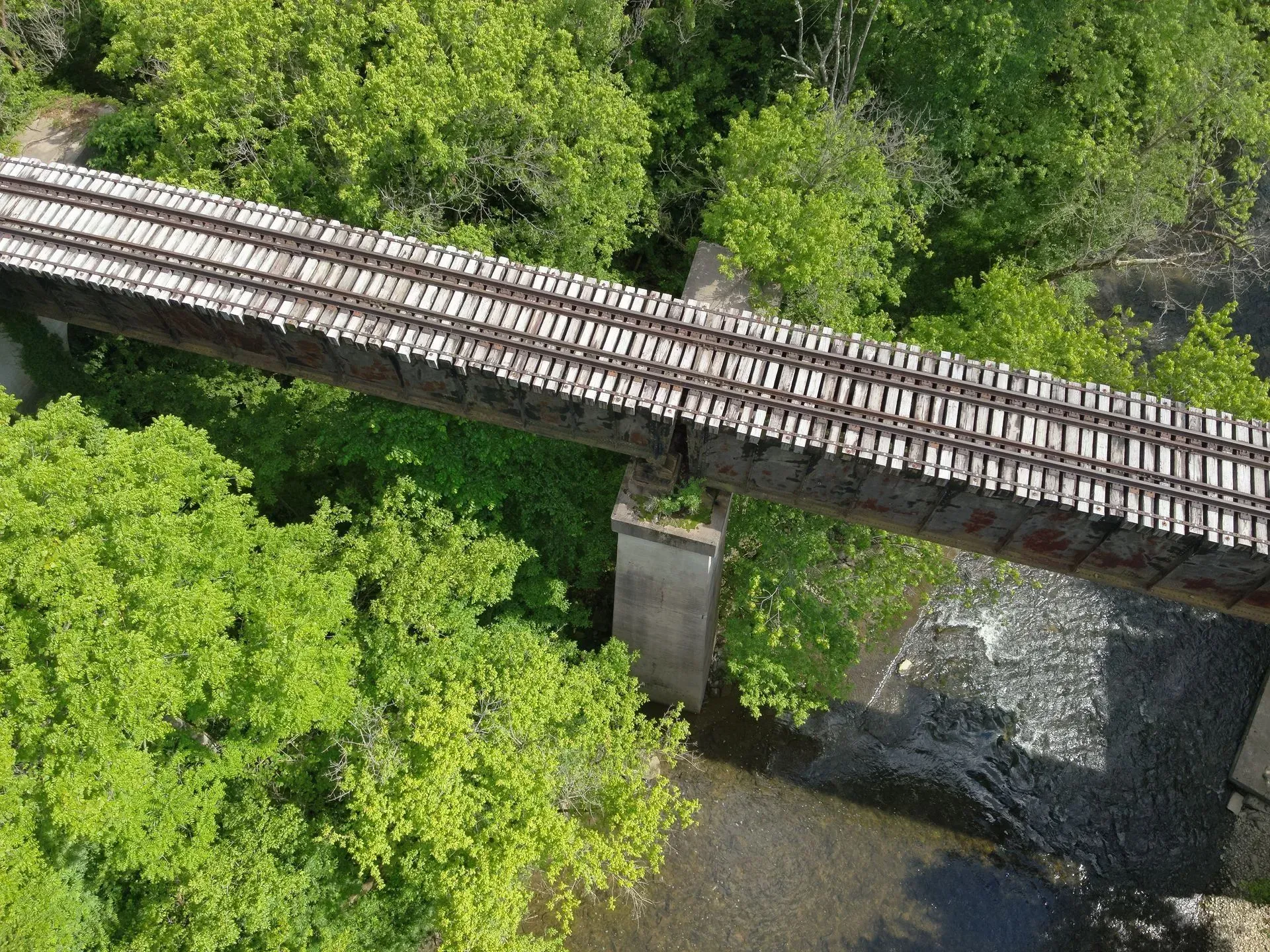
2. Infrastructure Inspection After Flooding
Ohio’s roads, bridges, and utilities are taking a beating this rainy season. Floodwaters compromise everything from bridge supports to utility lines. Our drone infrastructure inspections provide safe, accurate overviews of damage without risking human lives.
1st Choice Aerials inspects:
- County and township bridges
- Washed-out roadways
- Power substations and transmission lines
- Drainage and sewer infrastructure
We help get the data needed to safely reopen roads and begin repairs—fast.
3. Search and Rescue During Flooding
During major storms, thermal drones can locate people trapped by rising waters, even at night or in wooded terrain. Our team is trained to support search and rescue operations in flood zones using FLIR-equipped drones that detect heat signatures.
- Why use drones for flood rescue:
- Cover large areas quickly
- Safely reach inaccessible zones
- Provide aerial overwatch for rescue crews
We work directly with local fire departments and emergency agencies across Ohio to support rescue missions in real-time.
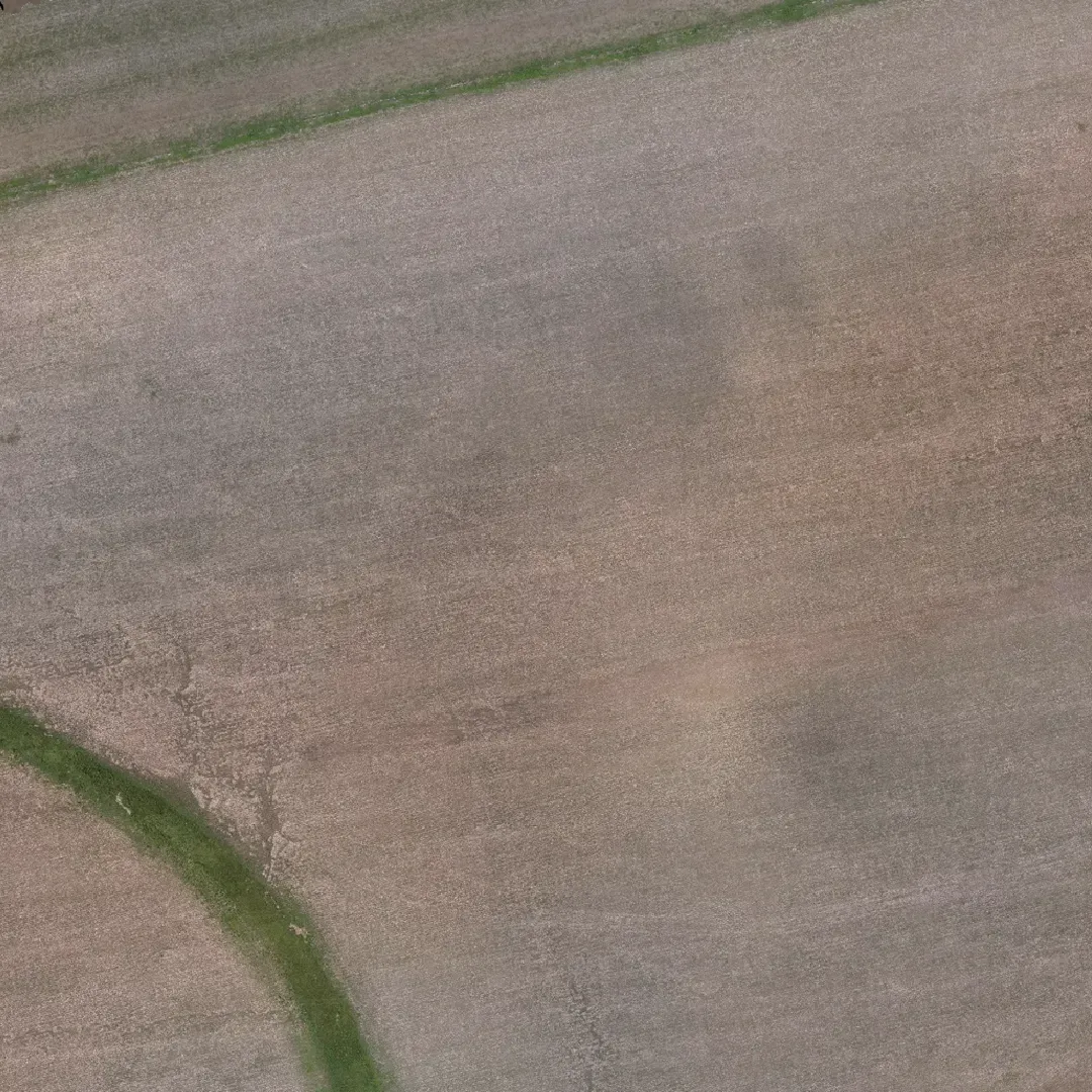
4. Drone-Based Flood Damage Assessment
After the storm, the work has just begun. 1st Choice Aerials offers detailed drone flood damage assessments to homeowners, farmers, and insurance providers. We fly over flooded properties and provide high-resolution imagery, thermal scans, and detailed mapping to identify all areas of damage.
This includes:
- Residential and commercial buildings
- Agricultural fields and livestock facilities
- Roads, culverts, and drainage ditches
Drone inspections allow for quick claims processing and documentation, reducing delays in funding and repairs.
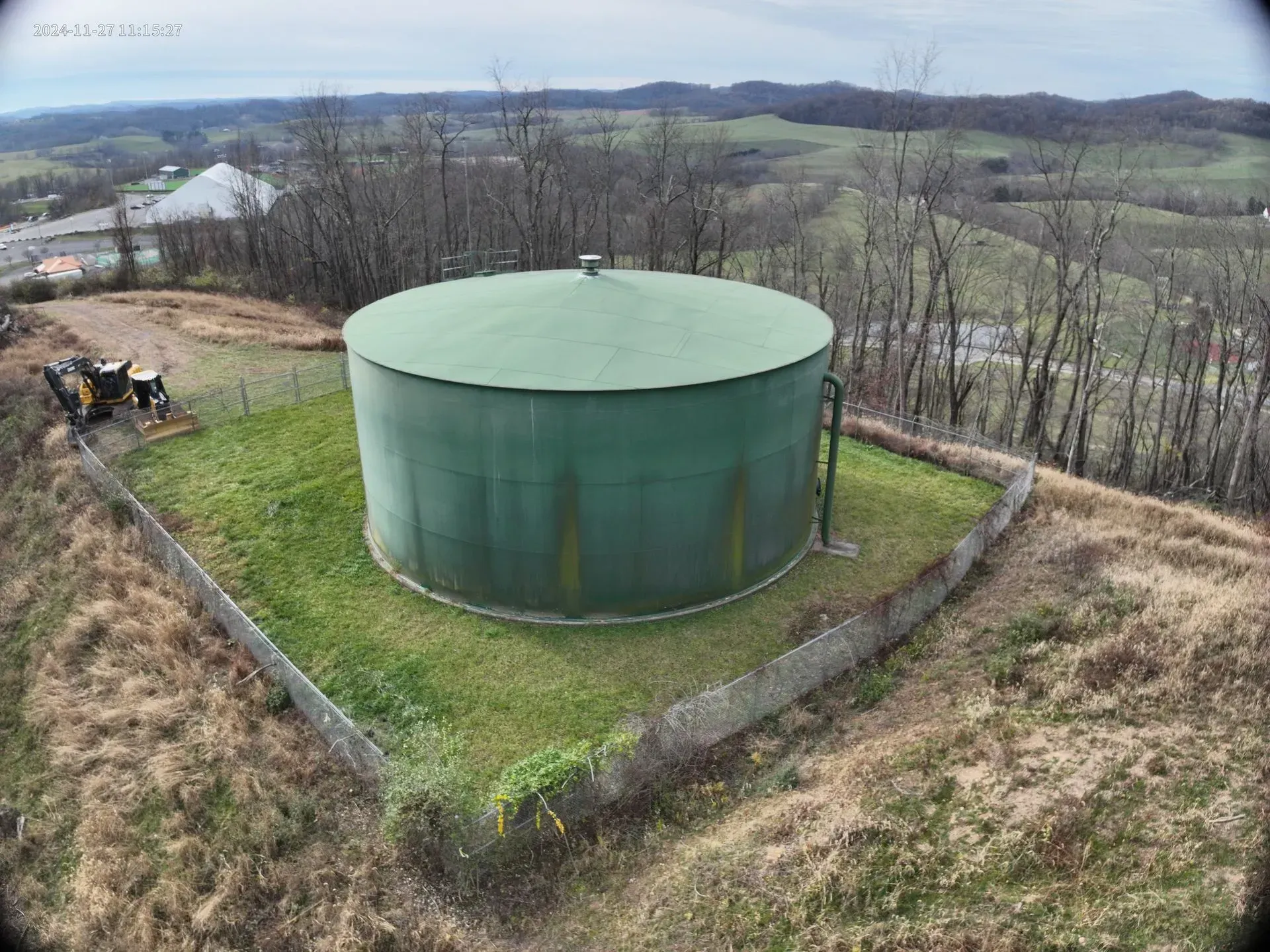
5. Monitoring Levees, Dams, and Waterways
Preventative inspections are just as important as post-disaster ones. With so much rainfall already recorded in Ohio—and more forecasted—now is the time to monitor levees, retention ponds, and drainage systems using drone technology.
- Routine drone inspections help:
- Identify weak spots before failure
- Track sediment buildup and erosion
- Monitor vegetation or blockages
This data is critical for engineers and public works departments to prevent future flooding disasters.
6. Communication and Coordination Support
In worst-case scenarios, flooding can knock out communication towers or prevent responders from reaching rural zones. Our drones can assist with aerial overwatch, communications relay (in certain setups), and provide livestream video to EOCs and command posts.
Stay Ahead of the Water with 1st Choice Aerials
Flooding across Ohio is no longer a once-a-decade event—it’s happening more frequently and with greater severity. At 1st Choice Aerials, we’re here to help you prepare, respond, and recover.
Our head pilot is a certified Firefighter I, bringing firsthand emergency response experience to every mission. That means every flight is led by someone who understands how critical timing, coordination, and safety are when lives and infrastructure are at risk.
Whether you're:
- A township trustee needing bridge inspections
- A farmer looking to document flood damage
- An emergency management team needing flood mapping or thermal drone support
- Anyone needing help with drone services
We’ve got the tools and the team to support your mission.
Based in Southern Ohio, we proudly serve the entire state and surrounding regions. As a, first responder-led company, you can count on us.
📞 Call us 24/7 at (937) 403-8622 for emergency response and inspections.
Government, public safety, and critical infrastructure requests are prioritized.