Drone Mapping Services for Construction Ohio: A Guide
In Ohio, drone mapping is changing the way construction is done.
This new technology offers better data, increased efficiency, and better planning for projects big and small, leading to improved results and cost savings.
If your construction business hasn't explored drone mapping services in Ohio, you could be missing out on significant advantages.
We'll cover the advantages, the drone technology involved, and the reasons for this upward trend.
Ready to view your construction project from new heights?
Contact 1st Choice Aerials today to schedule your aerial photography, inspection, or thermal imaging service!
On This Page:
What Are Drone Mapping Services?
Drones use high-tech cameras and sensors to take super detailed pictures and measurements of construction sites from above.
Specialized software crunches the gathered data, producing precise 3D models, orthomosaic maps, Digital Elevation Models (DEMs), and point clouds.
You can use these outputs for terrain analysis and material volume calculations for efficient project management.
An Ohio drone company specializing in these services can provide crucial support for construction purposes.
Benefits of Drone Mapping
Construction projects in Ohio are increasingly using drone technology; builders and developers are finding it very helpful. Here's why:
1. Saves Time and Money
Traditional surveying methods often involve considerable time and labor, leading to higher expenses.
Drones, however, can map large construction sites in a fraction of the time required by ground-based survey teams, saving time and money.
Preventing costly project delays is easy when we can grab data quickly and make decisions rapidly.
2. Improves Safety
Construction sites inherently present various hazards, from unstable ground to working at heights.
Drone inspection services reduce the need for workers to physically access dangerous or hard-to-reach areas for inspections or measurements, such as rooftops, bridges, or steep embankments.
This practice minimizes accidents and protects the company from potential lawsuits.
3. Increases Accuracy

Drone mapping services generate highly accurate data, with some systems achieving survey-grade level accuracy, especially when combined with ground control points (GCPs).
High-resolution aerial photos, detailed 3D models, and point cloud data help spot problems early in a building project.
Planning and execution improve dramatically with precision; the result? Far fewer errors.
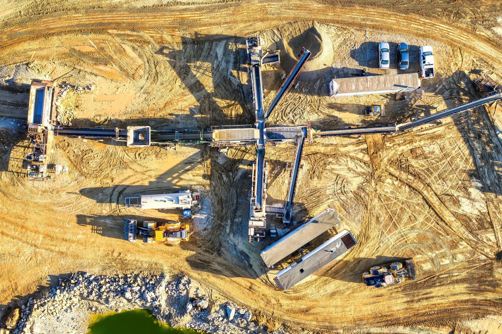
Popular Drone Mapping Services for Ohio Construction
Several types of drone mapping services offer distinct advantages for construction projects throughout Ohio.
We provide a full range of services. This includes:
Topographic Maps
Drones make super-accurate maps of construction sites, showing exactly how high or low the ground is everywhere.
This information benefits earthwork calculations, site grading, drainage, and overall site planning.
Progress Tracking
Conducting regular drone flights over a construction site allows for effective construction progress tracking over time.
These aerial surveys capture development's visual history.
Seeing how a project is coming along becomes easy for project managers.
They can verify completed tasks and catch delays before they become major issues.
Stakeholders also stay in the loop with easy access to progress photos and updated site maps.
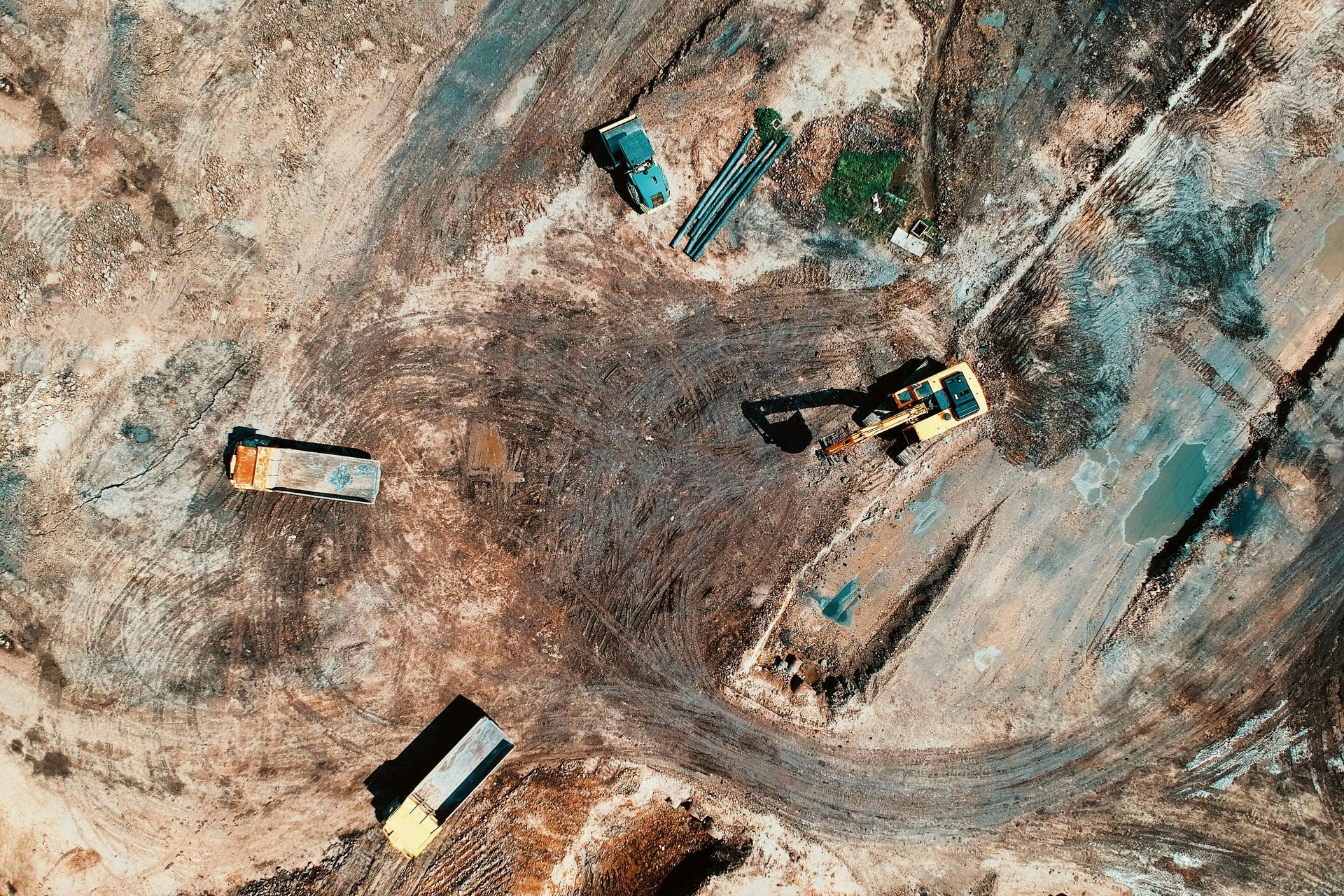
Volumetric Measurements
For construction projects involving large quantities of materials such as soil, gravel, sand, or aggregates, drones can accurately measure volumes, allowing you to track your inventory and spending effectively.
We make this happen by building exact 3D models of the piles of materials or dig sites.
Ohio's quarries, excavation sites, and big construction projects will find this feature incredibly handy.
Drone Inspection Services
Beyond mapping, drone inspection services are becoming increasingly popular.
Drones equipped with high-resolution cameras, thermal sensors, or LiDAR can inspect buildings, bridges, power lines, and other infrastructure with great detail.
This allows for the identification of structural defects, heat loss, water intrusion, or other issues without costly scaffolding or dangerous manual inspections.
As-Built Surveys and BIM Integration
Drone mapping provides highly accurate as-built surveys, capturing the exact state of a construction site or completed structure.
We can check the data against the Building Information Models (BIM) to see if everything matches up, or integrate them for a streamlined workflow.
This ensures early problem detection and ensures the project's alignment with the design specs.
Choosing a Drone Mapping Service in Ohio

If you are looking to implement drone mapping services for your Ohio construction project, selecting the right provider is important.
Not all drone service providers offer the same level of expertise or quality.
Consider the following factors to make an informed decision and find a reliable Ohio drone company:
Experience and Expertise
Look for providers with demonstrable experience in construction-specific drone mapping and aerial surveying.
Ohio construction presents specific challenges, and workers need to know the local geography and weather.
Ask for case studies or references from similar projects to gauge their capabilities.
Equipment and Technology
The quality of the drones, sensors (e.g., RGB, LiDAR, thermal), and software used significantly impacts the accuracy and utility of the final deliverables.
Ask about their drone tech. See how it helps your project, whether you need elevation models or super-detailed point clouds.
The software's advanced processing capabilities are key; they ensure the output is both precise and dependable.
Accurate data is a priority, achieved through the use of ground control points.
The ability to provide data in formats compatible with your existing software (e.g., CAD, GIS) is also an important consideration.
Effective data gathering, even in challenging terrain, depends on having the right equipment.
Compliance, Safety, and Insurance
It is critical that the drone service provider operates in full compliance with all Federal Aviation Administration (FAA) regulations, including Part 107 certification for their pilots.
Good insurance is also a must.
Liability coverage protects you and your stuff.
Safety protocols should be a top priority in all their operations, with clear procedures for risk assessment and mitigation on the construction site.
Ask about their safety record and training programs for their drone operators.
A professional ohio drone company will be transparent about their safety measures and regulatory compliance.
The Future of Drone Use in the Ohio Construction Industry

Ohio's construction is changing fast.
Improved drone technology and data processing will lead to even more creative uses for drones in the industry.
Projects are getting done faster, and the data is better.
This is great news for everyone involved!
Construction drone services have some really cool things coming up.
AI-Powered Analysis
Artificial intelligence (AI) and machine learning algorithms could analyze drone data even faster and more intelligently.
This might include automated detection of construction defects, real-time tracking of assets and equipment on site, or predictive analytics to identify potential project risks before they escalate.
With minimal human input, AI quickly processes huge sets of location information to give useful results.
Integration with Other Technologies
Drone mapping is likely to become more deeply integrated with other construction technologies.
This includes seamless workflows with Building Information Modeling (BIM), allowing for real-time comparison of as-built conditions with design models.
Integration with augmented reality (AR) could allow project managers to overlay drone-captured models onto the physical construction site for enhanced visualization and planning.
Expanded Capabilities and BVLOS Operations
Future drones may feature enhanced sensor payloads, such as more sophisticated LiDAR, hyperspectral cameras for material identification, or advanced environmental sensors for air and water quality monitoring.
Improved battery life and flight time?
That's more area covered and longer missions!
Approval of BVLOS operations is a game changer.
Large-scale mapping and inspection services will be transformed, especially for those long, sprawling infrastructure projects.
Maximize your drone mapping services: Here are some helpful tips.
Here are some practical tips for incorporating drone mapping into your Ohio construction project workflow.
Plan Regular Flights and Define Objectives
Schedule drone flights at regular intervals throughout your project lifecycle, from pre-construction to post-completion.
Tracking progress is easy when you gather data regularly.
Plus, you'll spot problems right away and build a helpful history of your work.
Clearly define the objectives for each flight mission – whether it's for topographic mapping, stockpile measurement, or progress photos – to ensure the collected data meets your specific needs.
Integrate with Your Existing Workflow

Work with your drone service provider to ensure the data deliverables integrate smoothly with your existing project management tools, CAD software, and GIS platforms.
Compatibility in data formats (e.g., LAS, GeoTIFF, OBJ) is crucial for efficiently using drone-captured information.
Train Your Team for Data Interpretation
Make sure your team members understand how to interpret and effectively use the data generated by drone mapping services.
This might involve some initial training on how to navigate 3D models and surface models, analyze point clouds, generate volumetric reports, or extract measurements from orthomosaic maps.
Establish Ground Control Points for High Accuracy
Ground control points (GCPs) are highly recommended for projects requiring a high level of accuracy, such as precise earthwork calculations or as-built verification.
GCPs are known points on the ground whose coordinates have been precisely measured by traditional surveying methods.
Using GCPs in drone mapping makes the maps and models far more accurate and easily meets professional standards.
Discuss the placement and measurement of control points with your drone service provider.
Overcoming Challenges in Drone Mapping for Ohio Construction
While drone mapping services offer numerous benefits for construction projects, there can be some challenges to address.
Planning ahead can really help you avoid problems.
Weather Conditions
Ohio's weather can be unpredictable, with conditions like high winds, rain, snow, or fog potentially impacting drone flight operations.
It is important to work closely with your drone service provider to schedule flights during optimal weather windows to ensure the best quality data capture and safety.
Data Management
Drone mapping creates a lot of data, including high-resolution pictures and dense point clouds.
Managing this data well means you can save it, arrange it, and access it quickly.
Think of it like organizing your closet – if you don’t know where things are, finding what you need is a lot harder.
Consider cloud-based storage solutions or robust local servers, and ensure you have the necessary processing power or software to handle large datasets if you plan to do any in-house analysis.
Your drone service provider will typically handle the initial processing, but understanding the data volumes and formats is important for long-term project archiving.
Regulatory Compliance and Privacy Concerns
Staying up-to-date with evolving FAA regulations concerning commercial drone use is vital.
Your chosen drone service provider should be fully compliant and knowledgeable about current rules, especially knowing the specifics of where and when you are allowed to fly.
Consider privacy when flying over or near private property.
Transparency and ethical conduct are vital; always respect individual rights.
This includes the rights of those who own the land you are flying over.
Talking openly with everyone involved about drone flights can really help ease people's worries.
Working with a reputable Ohio drone company that prioritizes legal and ethical operations is key, as it helps maintain a positive image.
Conclusion
If you are involved in the construction business in Ohio and have not yet explored the potential of drone mapping services, now is an opportune moment.
Consider adopting advanced aerial surveying—it's a powerful tool for gaining a competitive edge.
Think faster project completion, higher accuracy, and ultimately, more profit.
Seeing your project from above with a drone could totally change how you work and help you finish strong.
Ready to view your project from new heights?
Contact 1st Choice Aerials today to schedule your aerial photography, inspection, or thermal imaging service!