Drone Surveying for Construction Companies Ohio: A Guidemplate
If your construction business operates in the Buckeye State, you are likely considering how drone technology can benefit your operations.
Let's explore how drone surveys are revolutionizing the building industry in Ohio.
Come learn its upsides, how to apply it, and the first steps to kick things off.
Ready to view your construction project from new heights?
Contact 1st Choice Aerials today to schedule your aerial photography, inspection, or thermal imaging service!
On This Page:
What is Drone Surveying?
The process of drone aerial surveying typically involves mission planning, where flight paths are defined, followed by the drone flight operation for data collection, and finally, data processing using specialized software.
Truly precise maps and digital models deliver crucial data, guiding every step of a building project from initial planning to finishing touches.
You'll find this tech makes old surveying methods seem slow.
Ohio builders gain an edge with drone site surveys.
Drones are changing the game for construction work all over Ohio.
Think about big jobs in Columbus or new builds in Stark County – these flying gadgets bring some serious perks, helping teams see the site from above and get things done faster.
1. Improved Safety
In Ohio's diverse terrain, from bustling urban centers like Cleveland to expansive rural developments, drones navigate safely where human access might be restricted or dangerous.
From checking the highest points of a bridge to finding hidden cracks in the earth, these systems do the risky work.
That means no one has to put themselves in harm's way.
2. Time and Cost Savings
Traditional surveying methods often require considerable time and financial investment.
Drone surveying accelerates the data collection process dramatically; tasks that previously took days or even weeks can now often be completed in a matter of hours.
Snappy data collection puts more money back in your budget.
Consider the reduction in personnel needed on-site for surveying tasks and the speed at which aerial data can be gathered over large areas.
3. Increased Accuracy and Detailed Data

Drones equipped with high-resolution cameras, advanced sensors like drone LiDAR, integrating Ground Control Points (GCPs), and precise GPS technology can capture exceptionally detailed and accurate data.
Gathering a massive amount of data lets us show you exactly what the site looks like.
This kind of accuracy often beats what older land-measuring tools can do, especially when you're dealing with really tough ground.
Whether it's building a fancy new apartment complex in Cincinnati or laying down miles of new highway, getting things exactly right makes all the difference in Ohio's construction scene.
Comparing Drone Surveying with Traditional Surveying Methods
While traditional surveying methods have long been the standard, drone surveying offers distinct advantages in many scenarios.
We should also figure out what works well for each one.
Here's a breakdown for Ohio builders to pick wisely.
| Feature | Drone Surveying | Traditional Surveying Methods |
|---|---|---|
| Speed of Data Collection | Very fast; can cover large areas quickly. | Things can really slow down. This happens a lot with large or very involved sites. |
| Cost | Generally lower for large areas and frequent surveys due to reduced labor and time. | Can be higher due to more person-hours and longer project duration. |
| Safety | Significantly higher; reduces need for personnel in hazardous areas. | Higher risk exposure for surveyors in dangerous terrains or active sites. |
| Data Richness | Provides rich visual data (orthomosaics, 3D models, video) alongside survey-grade measurements. Delivers highly detailed geospatial data. | Primarily point-based data, though modern total stations can scan. |
| Accessibility | Excellent for hard-to-reach areas, unstable ground, and complex structures. | Limited by physical accessibility and safety constraints. |
| Accuracy | Can achieve survey-grade accuracy with proper techniques (e.g., ground control points, RTK/PPK GPS technology). Highly accurate for most construction purposes. | Historically the standard for high precision; can achieve very high accuracy for specific point measurements. |
| Weather Dependency | Flights can be affected by high winds, rain, or snow. | Less affected by weather, though extreme conditions can still hinder work. |
| Deliverables | Orthomosaic maps, digital elevation models (DEMs), digital surface models (DSMs), 3D point clouds, aerial photography, video. | Boundary plats, topographic maps, stake-outs, specific point coordinates. |
| Regulatory Oversight | Requires FAA certification (Part 107) for commercial use, adherence to airspace restrictions. | Well-established professional licensing and standards. |
For many construction projects in Ohio, a hybrid approach that combines the strengths of both drone aerial surveying and traditional methods might offer the best solution.
For instance, drones can rapidly map a large area for initial planning, while traditional surveying could be used for precise boundary definitions or setting specific control points.
Getting Started with Drone Surveying in Ohio
Adopting drone surveying services or developing in-house capabilities requires careful planning.
Here are steps for construction companies in Ohio, including those in Stark County or looking to provide services in Columbus, to integrate this technology.
1. Understand the Regulations
Before launching a drone program, it is essential to understand and comply with all applicable rules.
In Ohio, as in the rest of the United States, commercial drone operations fall under Federal Aviation Administration (FAA) regulations, primarily Part 107.
Drone operators must obtain a Remote Pilot Certificate.
Plus, if a drone weighs over 0.55 pounds, you must register it.
Operators must also adhere to airspace restrictions, avoid flying over people, and maintain a visual line of sight with the drone unless a waiver is obtained.
Some Ohio municipalities or specific locations (e.g., near airports) may have additional local ordinances or restrictions.
It is prudent to check with local authorities before commencing drone operations in any new area across Ohio, including major hubs.
2. Invest in the Right Equipment and Software
Selecting the appropriate drone and sensor payload is critical for effective construction surveying.
For most construction purposes, a drone with good flight stability, sufficient flight time (e.g., 25+ minutes per battery), and high-quality imaging capabilities is necessary.
Consider drones with RTK (Real-Time Kinematic) or PPK (Post-Processed Kinematic) GPS technology for enhanced accuracy, reducing the need for extensive ground control points.
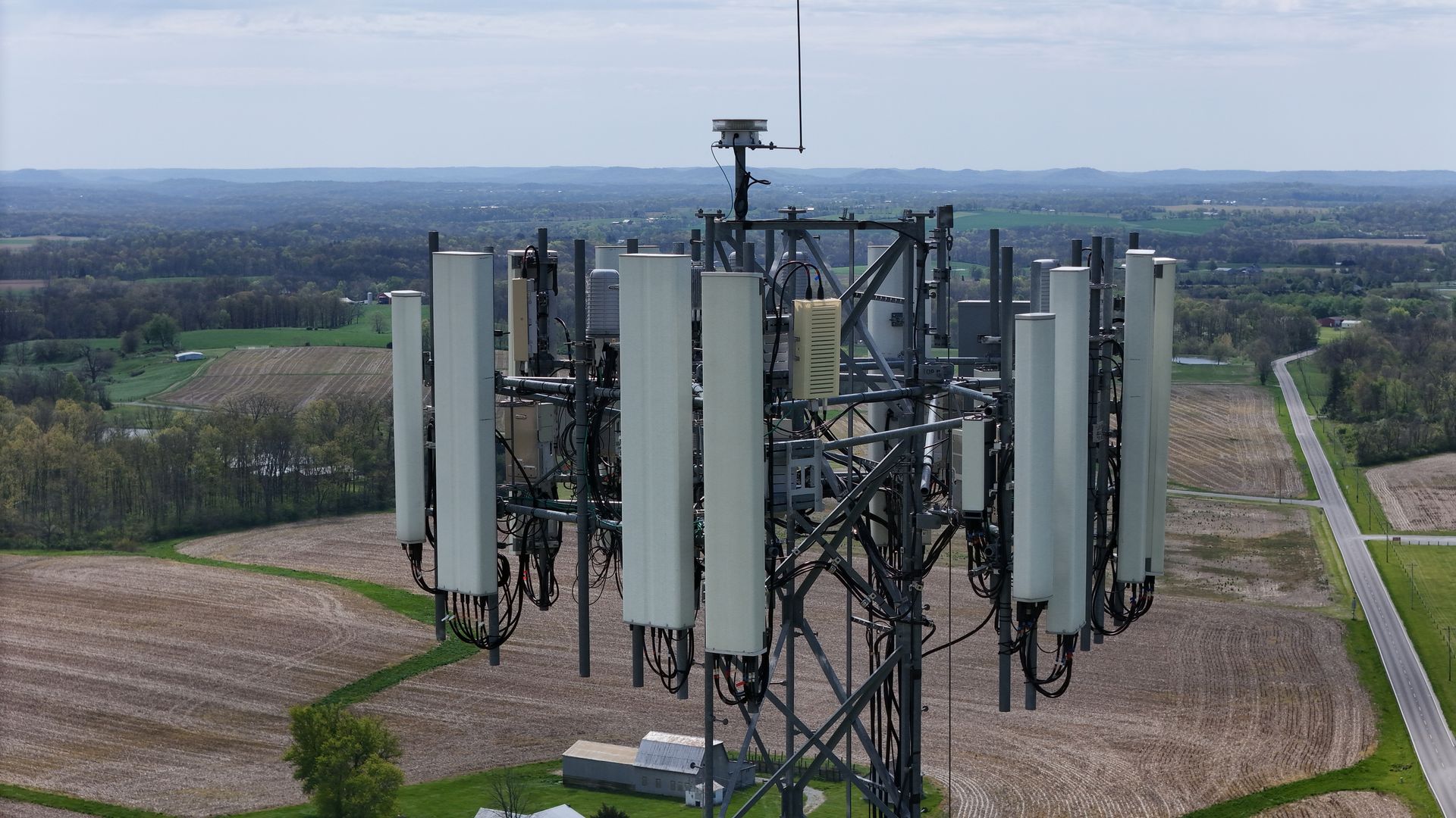
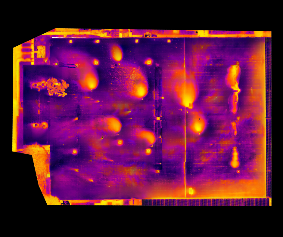
Sensor options include high-resolution RGB cameras for aerial photography and photogrammetry, multispectral sensors for environmental analysis, thermal cameras for heat-loss detection or electrical inspections, and drone LiDAR systems for capturing dense point clouds, especially in vegetated areas.
Factor in Ohio's variable weather conditions when choosing equipment; robustness and weather resistance can be important for year-round operations.
Specialized software is also needed for flight planning, data processing (to create orthomosaics, elevation models, and 3D models), and data analysis.
3. Train Your Team or Hire Professionals
Operating drones effectively and safely requires more than just basic piloting skills.
If you're flying drones for surveys, you'll need solid instruction.
Learn to fly the aircraft, understand FAA rules, practice safety, map out your missions, collect good data, and then process it all.
You need to understand what the drone sees and then integrate that into your building work.
Ohio's colleges and technical schools now offer classes and provide certificates for drone operation and working with map data.
Alternatively, construction companies can opt to hire a professional drone service provider.
Reputable drone services companies have experienced pilots, the latest technology, and expertise in delivering actionable insights for construction projects.
When selecting a top company, consider their experience in construction, specifically whether they've completed projects similar to yours.
4. Start Small and Scale Up

If you are new to drone surveying, it is wise to begin with a small pilot project or a specific application.
Your team can truly get familiar with the technology and fine-tune their work processes.
They'll grasp the real advantages directly, well before you commit to bigger operations.
You might start with using an aerial drone for simple site monitoring or capturing aerial images for marketing.
For example, a construction company could initially utilize drone technology for monthly progress monitoring on a single construction site.
As experience is gained and the value becomes evident, the use of drone aerial mapping can be expanded to include topographic surveys for new projects, volumetric calculations, or detailed building inspections.
Get ready for drones at Ohio job sites.
Drone tech keeps getting better.
This means construction sites will put them to work in many more ways.
Get ready for drones with far more advanced sensors, including LiDAR that won't break the bank.
You'll also notice significantly longer flight times because of better battery technology.
Get ready for artificial intelligence and machine learning to step up big time.
They'll automate how we sort through information, pulling out key discoveries from tons of aerial scans and flagging any trouble spots at lightning speed.
Collecting project data regularly and linking it with Building Information Modeling (BIM) systems ensures that building jobs run smoothly, from design to completion.
Providing drone services will become even more specialized, focusing on delivering highly detailed and actionable geospatial data.
Future developments may also include beyond visual line of sight (BVLOS) operations becoming more common with regulatory approvals, allowing for the survey of even larger areas more efficiently.
Conclusion
If you have not yet explored how drone surveying could benefit your Ohio construction company, now is an opportune time to investigate.
Imagine getting a full, detailed view of your job site from the sky.
Ready to view your project from new heights?
Contact 1st Choice Aerials today to schedule your aerial photography, inspection, or thermal imaging service!