Aerial Photography for Construction Sites Cincinnati
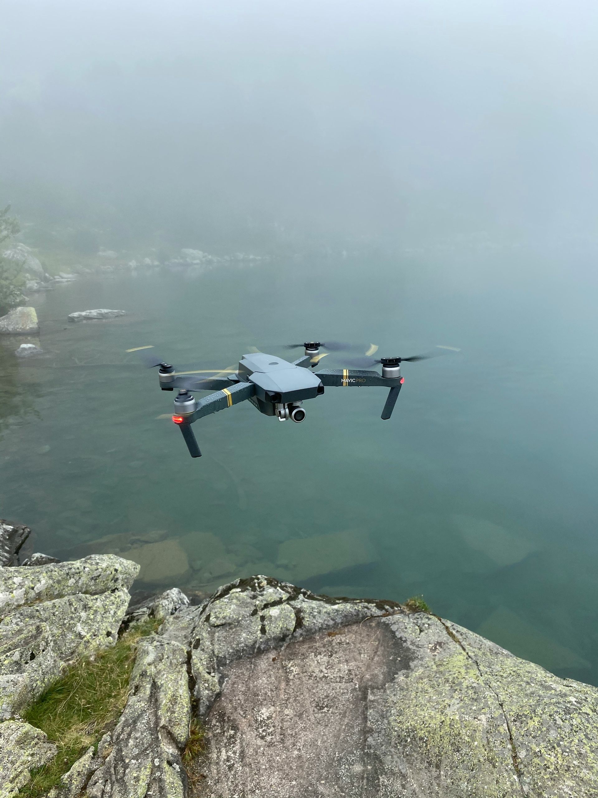
Getting aerial pictures for Cincinnati building projects is now a basic part of the job.
Project managers, architects, and engineers have significantly shifted their approach to work as a result.
Picture your whole job site from the sky, every little thing easy to spot.
Getting a clear view of this visual data truly helps us determine the best moves to make next.
Let's explore the significant advantages of aerial photography, its various applications, and why it's quickly becoming a must-have for construction projects.
Ready to view your construction project from new heights?
Contact 1st Choice Aerials today to schedule your aerial photography, inspection, or thermal imaging service!
On This Page:
Benefits of Aerial Photography for Construction Sites
The advantages of using drone aerial photography on a construction site are numerous and impactful.
1. Enhanced Project Planning
Aerial photos offer a comprehensive macro view of the entire construction site.
When you can see everything from this angle, your project plans become rock-solid, and your designs just click.
Seeing the entire property, plus what's right next to it, helps teams manage supplies and staff much better.
For example, a drone survey for a new commercial real estate development in downtown Cincinnati can help planners to optimize crane placement and material storage.
2. Improved Safety
When you're building, making sure everyone stays safe is a top priority.
Imagine spotting dangers from above, keeping your crew completely out of harm's way.
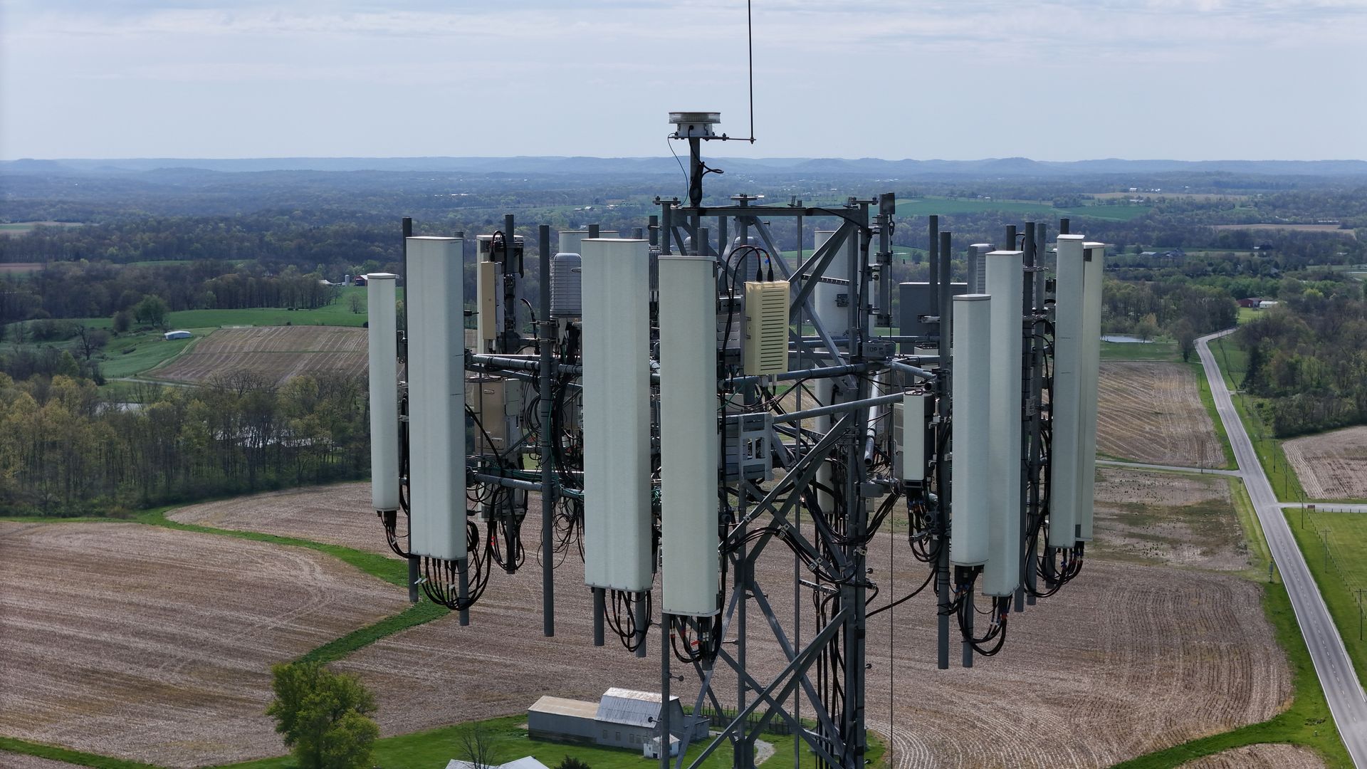
Drones can inspect hard-to-reach or hazardous areas like rooftops, bridges, or unstable terrain, thus reducing the need for risky manual inspections.
From above, cameras can spot if workers are following safety rules on a building site.
They might catch someone without a hard hat or walking into an area they shouldn't.
The turnaround times for receiving this data are often quick, allowing for immediate action.
3. Progress Tracking and Documentation
Consistent aerial shots create a comprehensive visual log of a project's advancement.
With detailed drone photos and aerial video, project managers gain clear site insights.
Clients see progress firsthand, and investors can confidently track their stakes.
It gives you the straight facts on where your tasks stand compared to their deadlines.
You can quickly spot if you're ahead, behind, or right on schedule, which makes managing your work much simpler.
Many Cincinnati contractors now integrate weekly drone footage into their client update packages.
When you're open, clients feel more satisfied and trust you deeply.
That openness also creates a clear history, perfect for settling disagreements or planning what's coming next.
4. Cost Savings
Although there's an initial outlay for drone technology or hiring a drone service, it frequently results in considerable long-term cost savings.
Aerial surveys can be performed swiftly and regularly, diminishing the necessity for labor-intensive manual inspections, measurements, and traditional surveying methods.
The quick turnaround times for data acquisition also mean less downtime for the construction crew.
Spotting issues quickly also saves money.
This also prevents pricey fixes and manages resources well.
Reduced insurance premiums can sometimes be another benefit, as safer sites mean fewer claims.
Applications of Aerial Photography in Cincinnati Construction

The applications of aerial drone photography in Cincinnati's construction sector are diverse and continue to expand.
Drones power a project's journey, from the first survey to its public debut.
Whether for headshots or product shots, these photo offerings truly adjust to what you need.
1. Site Surveys and Mapping
Before any construction begins, aerial photography is instrumental in generating precise and detailed site maps.
Effective site development, whether for a new house or a commercial building, relies heavily on these detailed maps during the initial planning and drawing phases.
Drones equipped with advanced technologies like LiDAR can produce highly accurate 3D models of the terrain and existing structures.
Spotting hidden land shapes or someone building where they shouldn't is another benefit of these surveys.
2. Progress Monitoring
Regular aerial shots allow project managers to visually track progress with exceptional clarity.
For huge building sites or really tricky jobs, a view from the ground often won't show you the whole story.
An updated drone photo can reveal a lot about the day-to-day changes on a construction site.
3. Equipment and Material Management
Aerial views from a Cincinnati drone assist in managing on-site resources with greater efficiency.
Drone pictures let project managers pinpoint the location and movement of all heavy equipment and material piles on site.
Making things work better means we toss out less, and nothing goes missing.
Every single item is ready and waiting exactly where and when it's supposed to be.
Think of all the hours you'll get back, no longer tied up counting every last piece of stock.
4. Marketing and Client Communication

High-quality aerial images and compelling aerial video are potent marketing tools for the real estate and construction industries.
From projects just starting to those fully built, they display striking images.
These visuals go to future clients, investors, and the public, showing what's possible.
These pictures instantly make a project much more appealing.
Several Cincinnati real estate developers now prominently feature drone footage in their marketing brochures, websites, and presentations.
Choosing the Right Aerial Photography Service in Cincinnati
With the escalating demand for aerial imaging, numerous companies now offer aerial photography services for construction sites in Cincinnati.
You'll get much better results when you pick a solid drone service.
Making your pick? Hold onto these thoughts.
- FAA Certification: Crucially, ensure the company and its drone pilot personnel are FAA certified for commercial drone operations. This is a non-negotiable legal and safety requirement for any aerial drone work.
- Experience: Look for drone photographers with specific, demonstrable experience in construction site photography and videography. Ask for a portfolio showcasing similar projects in Cincinnati, Ohio, or relevant sectors. Experience on a large construction site is a plus.
- Equipment Quality: Inquire about the drones and camera equipment they use. Sharp, detailed aerial photos and drone videos rely on excellent gear: high-res cameras, stable drones, and a good array of lenses.
- From organizing your data to handing over the final work, we cover it all. Get a clear picture of what happens to the information once we gather it: how it's prepared, stored, and then shared. Clarify formats, turnaround times, and accessibility of the drone photos and videos. Ensure they provide drone data in a usable format for your needs.
- Insurance: Before they start, ask if the company has enough liability insurance for their drone projects. This protects your project and property in the unlikely event of an incident.
- Local Knowledge: Providers familiar with Cincinnati's unique urban landscape, airspace restrictions, and local regulations can offer more efficient and compliant aerial services. They are better equipped to handle logistical challenges specific to the area.
- Client Testimonials: Look for strong recommendation statements or reviews.
Legal Considerations for Aerial Photography in Cincinnati
While aerial photography provides numerous advantages, it's vital to understand the legal framework governing its use.
In Cincinnati, as throughout the United States, drone operations are regulated by the Federal Aviation Administration (FAA).
All drone services simply have to follow these rules.
Key legal and regulatory points to remember include:
- Drone Registration: All drones used for commercial purposes, and many recreational ones, must be registered with the FAA. The drone pilot should be able to provide proof of
- registration for their equipment.
- Operator Licensing: Operators conducting commercial drone flights must possess a Part 107 Remote Pilot Certificate from the FAA. A certified pilot knows airspace rules, drone limits, and how to fly safely.
- Airspace Restrictions: Flights near airports, stadiums, critical infrastructure, or in other restricted airspace zones require special FAA authorization (e.g., LAANC). Cincinnati has specific airspace considerations due to its airports and urban density.
- Privacy Concerns: Drone operators must respect privacy laws. This is particularly important when flying near residential real estate or private properties not part of the construction site. Avoid capturing identifiable individuals without consent.
- Local Ordinances: While federal law generally preempts local drone regulations concerning airspace, some municipalities might have ordinances regarding drone take-off and landing on public property. It's good to be aware of any Cincinnati-specific rules.
Consulting with a legal expert familiar with both federal and local Cincinnati drone regulations is a prudent step.
Following these rules makes sure everything is done correctly.
This keeps your project safe from legal action and costly penalties.
The Future is Up
Cincinnati's building companies are increasingly utilizing drones and aerial photos.
Drone photography and videography tools keep getting more advanced.
This opens up many clever ways to use them.
- AI Integration: Artificial intelligence and machine learning will be increasingly integrated with aerial imaging data. It handles project progress checks against BIM data, confirms safety standards are met, and spots flaws at the building site—all automatically.
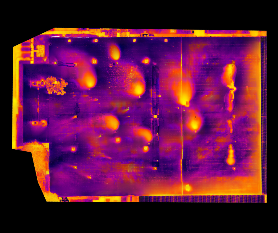
- Advanced Sensors: Drones will carry more sophisticated sensors beyond standard cameras. Thermal imaging for energy efficiency audits and identifying heat loss, as well as multispectral sensors for environmental monitoring, will become increasingly common in various photography services.
- Augmented Reality (AR) and Virtual Reality (VR): Combining drone photos and 3D models with AR/VR technologies will offer immersive project visualization. Stakeholders could virtually walk through a site or see proposed designs overlaid on the actual footage of the current state.
- Imagine drones working inside. Newer drone tech makes flying them inside much steadier. Drones will soon zip through massive indoor spaces, like giant warehouses or half-finished building floors, giving us clear views of every hidden corner.
- Enhanced Data Analytics: The focus will shift from just capturing drone aerial data to extracting more actionable insights. Imagine having tools that let you really see what's going on and guess what's coming next. You can use them for a fast, one-off project or to handle long-term property investments.
Conclusion
Aerial photography for construction sites in Cincinnati is far more than a passing trend.
With its spot-on view, this strong new method is totally changing how the construction business operates.
From substantially improved project planning and enhanced safety protocols to more effective client communication and marketing, the benefits of utilizing a professional drone service are undeniable.
And the future looks even brighter.
Ready to view your project from new heights?
Contact 1st Choice Aerials today to schedule your aerial photography, inspection, or thermal imaging service!